Latitude: 51.4765 / 51°28'35"N
Longitude: -2.629 / 2°37'44"W
OS Eastings: 356412
OS Northings: 175470
OS Grid: ST564754
Mapcode National: GBR C09.GK
Mapcode Global: VH88M.D40Y
Plus Code: 9C3VF9GC+JC
Entry Name: Stoke House Annex
Listing Date: 30 December 1994
Grade: II
Source: Historic England
Source ID: 1292911
English Heritage Legacy ID: 380622
ID on this website: 101292911
Location: Sneyd Park, Bristol, BS9
County: City of Bristol
Electoral Ward/Division: Stoke Bishop
Parish: Non Civil Parish
Built-Up Area: Bristol
Traditional County: Gloucestershire
Lieutenancy Area (Ceremonial County): Bristol
Church of England Parish: Stoke Bishop
Church of England Diocese: Bristol
Tagged with: Architectural structure
BRISTOL
ST5675 STOKE HILL, Stoke Bishop 901-1/31/2013 (North East side) Stoke House annex
GV II
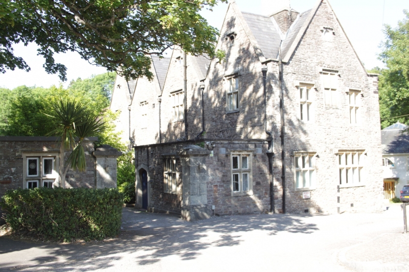
House, now college. Dated 1669, partly refenestrated mid C19. Pennant rubble with limestone dressings, diagonally-set ridge ashlar stacks and a slate cross-gabled roof. Double-depth plan. 2 storeys and attic; 4-gable range. Steep gaples to front sides and back, some with square finials with pyramidal tops; C19 four-centred doorway to left of centre has a label mould and Prince of Wales' feathers above; cross windows with label moulds, a 7-light left-hand ground-floor transomed window with a 4-centred arch in ashlar surround, and rectangular panels with oval lights and labels in the gables. INTERIOR: remodelled mid C20, recent roof. Shown on Kip's engraving of Stoke House (qv).
Listing NGR: ST5641275470
External links are from the relevant listing authority and, where applicable, Wikidata. Wikidata IDs may be related buildings as well as this specific building. If you want to add or update a link, you will need to do so by editing the Wikidata entry.


Other nearby listed buildings