Latitude: 54.0748 / 54°4'29"N
Longitude: -2.8578 / 2°51'27"W
OS Eastings: 343970
OS Northings: 464655
OS Grid: SD439646
Mapcode National: GBR 8PHB.32
Mapcode Global: WH840.2VF2
Plus Code: 9C6V34FR+WV
Entry Name: Wall Enclosing Churchyard at Parish Church of the Holy Trinity
Listing Date: 6 April 1979
Grade: II
Source: Historic England
Source ID: 1292918
English Heritage Legacy ID: 391816
ID on this website: 101292918
Location: Morecambe Parish Church, Morecambe, Lancaster, Lancashire, LA4
County: Lancashire
District: Lancaster
Civil Parish: Morecambe
Built-Up Area: Morecambe
Traditional County: Lancashire
Lieutenancy Area (Ceremonial County): Lancashire
Church of England Parish: Poulton-le-Sands Holy Trinity
Church of England Diocese: Blackburn
Tagged with: Wall
MORECAMBE AND HEYSHAM
SD4364 CHURCH STREET, Morecambe 939-1/5/32 Wall enclosing churchyard at Parish 06/04/79 Church of The Holy Trinity
GV II
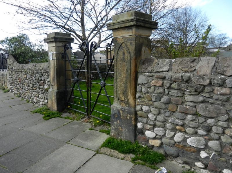
Churchyard wall. Mid C19. Cobbles and sandstone rubble with triangular capping. Encloses 4 sides of the churchyard surrounding the Church of the Holy Trinity. The eastern length of wall, bordering Church Street, contains a pair of gate piers and gates to each side of the church (qv), and a 3rd pair to the south which is probably contemporary with the church, although moved, and has lancet panels carved on the pier faces.
Listing NGR: SD4397064655
External links are from the relevant listing authority and, where applicable, Wikidata. Wikidata IDs may be related buildings as well as this specific building. If you want to add or update a link, you will need to do so by editing the Wikidata entry.


Other nearby listed buildings