Latitude: 52.6388 / 52°38'19"N
Longitude: -1.6539 / 1°39'13"W
OS Eastings: 423520
OS Northings: 304616
OS Grid: SK235046
Mapcode National: GBR 5GS.GPR
Mapcode Global: WHCGY.KXNX
Plus Code: 9C4WJ8QW+GF
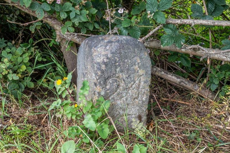
Entry Name: Coventry Canal Milepost Approximately 107 Metres to North East of Bridge Number 65
Listing Date: 28 February 1992
Grade: II
Source: Historic England
Source ID: 1293350
English Heritage Legacy ID: 386475
ID on this website: 101293350
Location: Tamworth, Staffordshire, B77
County: Staffordshire
District: Tamworth
Electoral Ward/Division: Amington
Parish: Non Civil Parish
Built-Up Area: Tamworth
Traditional County: Warwickshire
Lieutenancy Area (Ceremonial County): Staffordshire
Church of England Parish: Amington
Church of England Diocese: Birmingham
Tagged with: Milestone Architectural structure
TAMWORTH
SK20SW COVENTRY CANAL, Amington 670-1/4/6 Milepost approx. 107m to NE of Bridge No 65
GV II
Milepost. 1785-90. Dressed stone. Short square stone with rounded cap, set diagonally, with inscribed figures to adjacent faces: 8 to left (Fradley); 24 to right (Coventry). (Canals of the British Isles: Hadfield C: Canals of the East Midlands: London: 1966-: P.23-24).
Listing NGR: SK2352004616
External links are from the relevant listing authority and, where applicable, Wikidata. Wikidata IDs may be related buildings as well as this specific building. If you want to add or update a link, you will need to do so by editing the Wikidata entry.


Other nearby listed buildings