Latitude: 53.7471 / 53°44'49"N
Longitude: -0.3373 / 0°20'14"W
OS Eastings: 509744
OS Northings: 429143
OS Grid: TA097291
Mapcode National: GBR GNN.C5
Mapcode Global: WHGFR.S2KQ
Plus Code: 9C5XPMW7+R3
Entry Name: Number 8 and Attached Railings
Listing Date: 12 November 1973
Last Amended: 21 January 1994
Grade: II
Source: Historic England
Source ID: 1297006
English Heritage Legacy ID: 387635
ID on this website: 101297006
Location: Kingston upon Hull, East Riding of Yorkshire, HU1
County: City of Kingston upon Hull
Electoral Ward/Division: Myton
Parish: Non Civil Parish
Built-Up Area: Kingston upon Hull
Traditional County: Yorkshire
Lieutenancy Area (Ceremonial County): East Riding of Yorkshire
Church of England Parish: Sculcoates All Saints
Church of England Diocese: York
Tagged with: Building
KINGSTON UPON HULL
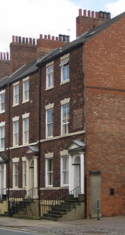
TA0929SE JARRATT STREET 680-1/18/217 (South side) 12/11/73 No.8 and attached railings (Formerly Listed as: JARRATT STREET (South side) No.8)
GV II
House and attached railings. c1800, with mid C19 and late C20 alterations. Brick with rendered basement and painted ashlar dressings, with concrete tile roof and single side wall stack. Basement lintel band, ground and first-floor sill bands. 3 storeys plus basement; 2-window range. Windows are plain sashes, those to the second floor smaller, with slightly cambered multi keystone lintels. Ground floor has to right, steps to a restored doorcase with Doric columns and dentillated pediment, with fielded 6-panel door and plain fanlight. Basement has an altered plain sash flanked to right by a 4-panel door. Outside, cast-iron area railings.
Listing NGR: TA0974429143
External links are from the relevant listing authority and, where applicable, Wikidata. Wikidata IDs may be related buildings as well as this specific building. If you want to add or update a link, you will need to do so by editing the Wikidata entry.


Other nearby listed buildings