Latitude: 51.6705 / 51°40'13"N
Longitude: 0.3844 / 0°23'3"E
OS Eastings: 564976
OS Northings: 199546
OS Grid: TQ649995
Mapcode National: GBR NJW.805
Mapcode Global: VHJKD.M81R
Plus Code: 9F32M9CM+5P
Entry Name: 98, High Street
Listing Date: 10 April 1967
Last Amended: 9 December 1994
Grade: II*
Source: Historic England
Source ID: 1297194
English Heritage Legacy ID: 373672
ID on this website: 101297194
Location: Ingatestone, Brentwood, Essex, CM4
County: Essex
District: Brentwood
Civil Parish: Ingatestone and Fryerning
Built-Up Area: Ingatestone
Traditional County: Essex
Lieutenancy Area (Ceremonial County): Essex
Church of England Parish: Ingatestone St Edmund and St Mary
Church of England Diocese: Chelmsford
Tagged with: Building
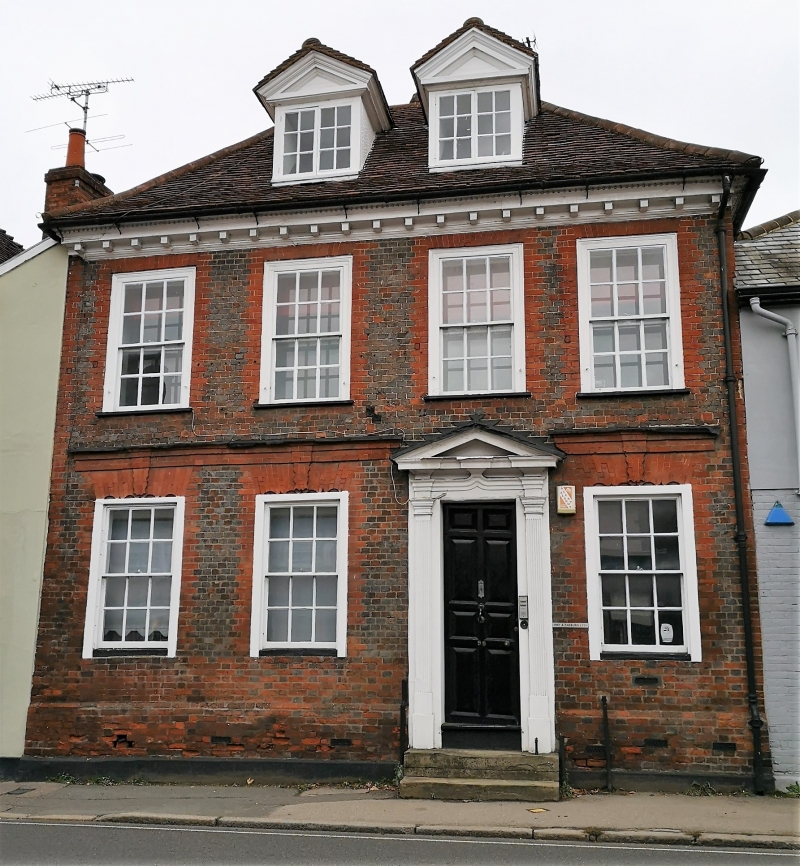
INGATESTONE AND FRYERNING TQ6499 HIGH STREET, Ingatestone 723-1/14/387 (North West side) 10/04/67 No.98 (Formerly Listed as: BRENTWOOD HIGH STREET, Ingatestone (North West side) No.98 GV II* House, now offices. Early C18, extended in C19/20. Timber-framed, facade of blue bricks in header bond with red brick dressings, remainder plastered, roofed with handmade red clay tiles. T-plan facing SE, with a stack at the centre. Single-storey lean-to extension in rear left angle. From the rear right angle a series of late C19 additions extend backwards, 2-storey and one-storey, all of red brick in Flemish bond with hipped roofs of machine-made red clay tiles, ending with a C20 single-storey extension with a flat roof. 2 storeys and attic. Asymmetrical elevation. Ground floor, 3 altered sashes of 6+6 lights, with flat arches of gauged red brick, the soffits and projecting keys elaborately profiled. First floor, 4 sashes of 6+6 lights, with flat arches of gauged red brick. 2 casements in gabled dormers. Door of 8 fielded panels with wooden doorcase comprising fluted pilasters, moulded frieze rising to a point in the centre, and moulded pediment. 2 stone steps with cast iron bootscraper set in upper step. The brickwork below the ground-floor windows is red and in Flemish bond, with a weathered brick plinth and a rendered-cement plinth below. Raised band of rubbed red brick immediately above the ground-floor window arches, continuing the projection of the keys. Dentilled and moulded eaves cornice, continuing round right return to meet the roof of the adjacent house. Fully hipped roof. The dormers have moulded eaves cornice and pediments. The profiled arches of the ground-floor windows are similar to, but not identical in shape with, those at Ray Place Farmhouse, Blackmore (qv) which: is dated by inscription to 1721, indicating a similar date of construction and possibly the same master mason. In the rear elevation of the original rear wing, on the first floor, is an early C19 sash of 8+8 lights with some crown glass. INTERIOR: in the right front ground-floor room is an attached corner cupboard with a full-height mahogany door of 6 fielded panels, with reeded and jewel-moulded pilasters of later date. At the rear of this room is a moulded archway with semi-elliptical head, leading to the original stair, from ground floor to attic, of 3 straight flights to each storey, with a moulded handrail, turned balusters and open well (the well filled in later on the ground floor). On the first floor are 2 hearths facing diagonally forwards; the right hearth has a cast-iron ducknest grate of c1800, the left hearth is obscured by furniture and believed to be blocked. The roof structure is original and partly exposed, of hardwood.
Listing NGR: TQ6497699546
External links are from the relevant listing authority and, where applicable, Wikidata. Wikidata IDs may be related buildings as well as this specific building. If you want to add or update a link, you will need to do so by editing the Wikidata entry.


Other nearby listed buildings