Latitude: 54.8967 / 54°53'48"N
Longitude: -2.9415 / 2°56'29"W
OS Eastings: 339713
OS Northings: 556181
OS Grid: NY397561
Mapcode National: GBR 7CWT.YG
Mapcode Global: WH802.S5GY
Plus Code: 9C6VV3W5+M9
Entry Name: Bridge over Outer Moat
Listing Date: 1 June 1949
Grade: I
Source: Historic England
Source ID: 1297365
English Heritage Legacy ID: 386572
ID on this website: 101297365
Location: Caldewgate, Cumberland, Cumbria, CA3
County: Cumberland
District: Carlisle
Parish: Non Civil Parish
Built-Up Area: Carlisle
Traditional County: Cumberland
Lieutenancy Area (Ceremonial County): Cumbria
Church of England Parish: Carlisle St Cuthbert with St Mary
Church of England Diocese: Carlisle
Tagged with: Bridge Driveway bridge
CARLISLE
NY3956SE CARLISLE CASTLE 671-1/6/2 Bridge over outer moat 01/06/49
GV I
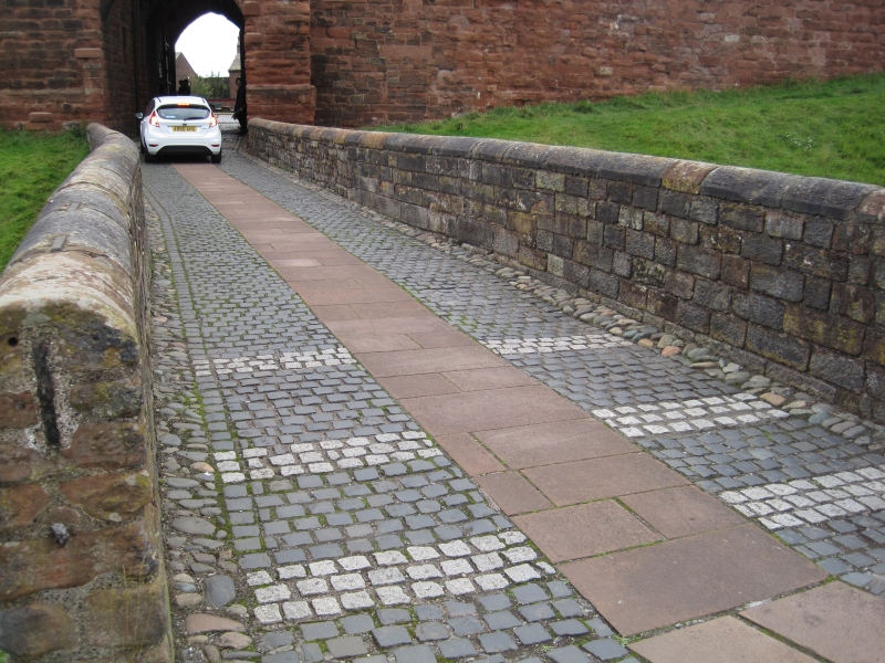
Drawbridge, converted to overbridge. Part medieval with late C18 additions and C20 part-rebuilding of parapet. Large blocks of squared red sandstone. At the base of the bridge are the drawbridge abutments; heightened between 1778-1791 and brick arch added. West solid parapet has coping inscribed by various C19 soldiers who served in the garrison; the right parapet has been rebuilt using new coping. The roadway is of Whin sets and a central sandstone pedestrian walk, all reset in the late 1980s. For full details see McCarthy et al (1990). A watercolour of Carlisle Castle by Robert Carlyle shows the arched bridge in 1791 (not on Hearne's engraving of 1778). (Carlisle Castle: A survey and documentary history: McCarthy MR: London: 1990-).
Listing NGR: NY3971356181
External links are from the relevant listing authority and, where applicable, Wikidata. Wikidata IDs may be related buildings as well as this specific building. If you want to add or update a link, you will need to do so by editing the Wikidata entry.


Other nearby listed buildings