Latitude: 50.1679 / 50°10'4"N
Longitude: -5.1015 / 5°6'5"W
OS Eastings: 178607
OS Northings: 34365
OS Grid: SW786343
Mapcode National: GBR ZC.GF45
Mapcode Global: FRA 086K.VSG
Plus Code: 9C2P5V9X+59
Entry Name: The Kings Arms Hotel
Listing Date: 22 September 1971
Grade: II
Source: Historic England
Source ID: 1298624
English Heritage Legacy ID: 365719
ID on this website: 101298624
Location: Penryn, Cornwall, TR10
County: Cornwall
Civil Parish: Penryn
Built-Up Area: Penryn
Traditional County: Cornwall
Lieutenancy Area (Ceremonial County): Cornwall
Church of England Parish: St Gluvias
Church of England Diocese: Truro
Tagged with: Hotel
PENRYN
SW7834SE BROAD STREET 580-1/6/36 (North side) 22/09/71 The Kings Arms Hotel
GV II
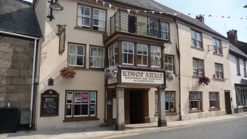
Public house. C17, refronted mid C19. Stucco on rubble front; steep scantle slate roof half-hipped on left with brick end stacks, rear lateral rubble stack; cast-iron ogee gutter. U-shaped plan including 2 rear wings at right angles. 3 storeys; 4-window range. Wide window openings with late C19 pairs of horned sashes to upper floors and tripartite sashes to ground floor; main doorways towards left with 4-pane door and open porch on square granite columns supporting a small 1st-floor chamber with 3 linked sashes with pilasters to sash boxes and moulded entablature and similar pair of sashes to each side. 6-panel door at far right. INTERIOR: original but heightened chamfered granite fireplace to ground floor left. Said to have many features of interest to upper floors.
Listing NGR: SW7860734364
External links are from the relevant listing authority and, where applicable, Wikidata. Wikidata IDs may be related buildings as well as this specific building. If you want to add or update a link, you will need to do so by editing the Wikidata entry.


Other nearby listed buildings