Latitude: 50.5167 / 50°31'0"N
Longitude: -3.7533 / 3°45'11"W
OS Eastings: 275792
OS Northings: 70011
OS Grid: SX757700
Mapcode National: GBR QJ.1TRS
Mapcode Global: FRA 370P.RKT
Plus Code: 9C2RG68W+MM
Entry Name: 57, East Street
Listing Date: 1 September 1992
Grade: II
Source: Historic England
Source ID: 1298789
English Heritage Legacy ID: 376042
ID on this website: 101298789
Location: Ashburton, Teignbridge, Devon, TQ13
County: Devon
District: Teignbridge
Civil Parish: Ashburton
Built-Up Area: Ashburton
Traditional County: Devon
Lieutenancy Area (Ceremonial County): Devon
Church of England Parish: Ashburton St Andrew
Church of England Diocese: Exeter
Tagged with: Building
ASHBURTON
SX7570 EAST STREET 849-1/9/64 (North side) No.57
GV II
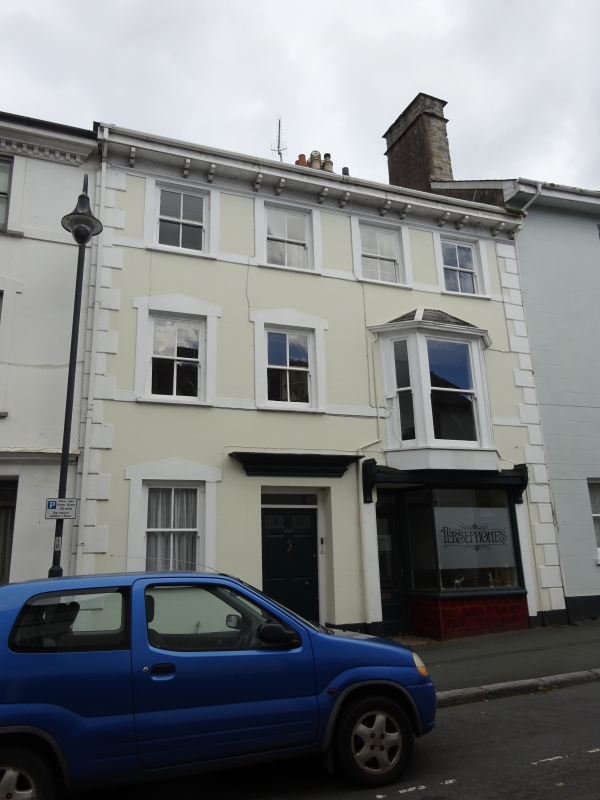
House with shop. Mid C19; basically perhaps a little older. Solid rendered front. Slated roof. Red-brick chimney on each gable end. 3 storeys. 4 windows wide. Ground storey has 6-panelled house door in place of second window from left, the 2 bottom panels flush; old knocker and letterbox. Above the doorway a large moulded cornice. To left, a 2-paned sash window in shaped surround. To right a late C19 or early C20 shop front with base of brown glazed tiles. Upper storey windows have mostly 2-paned sashes in plain surrounds with continued sills; those in second storey have shaped surrounds matching that to left of ground storey. Right-hand second storey window differs in having a canted bay with pent roof (probably late C19). Whole front flanked by raised quoins. Deep eaves-cornice with paired brackets.
Listing NGR: SX7579270011
External links are from the relevant listing authority and, where applicable, Wikidata. Wikidata IDs may be related buildings as well as this specific building. If you want to add or update a link, you will need to do so by editing the Wikidata entry.


Other nearby listed buildings