Approximate Location Map
Large Map »
Latitude: 51.4038 / 51°24'13"N
Longitude: 0.0043 / 0°0'15"E
OS Eastings: 539509
OS Northings: 169106
OS Grid: TQ395691
Mapcode National: GBR L6.CRR
Mapcode Global: VHHNX.1Z36
Plus Code: 9F32C233+GP
Entry Name: Main Pumping Station
Listing Date: 5 March 1976
Grade: II
Source: Historic England
Source ID: 1298989
English Heritage Legacy ID: 358664
ID on this website: 101298989
Location: Shortlands, Bromley, London, BR2
County: London
District: Bromley
Electoral Ward/Division: Shortlands
Parish: Non Civil Parish
Built-Up Area: Bromley
Traditional County: Kent
Lieutenancy Area (Ceremonial County): Greater London
Church of England Parish: Shortlands St Mary
Church of England Diocese: Rochester
Tagged with: Pumping station Architectural structure
VALLEY ROAD
1.
4407 (North East Side)
Main Pumping
TQ 36 NE 2/308 Station
II
2.
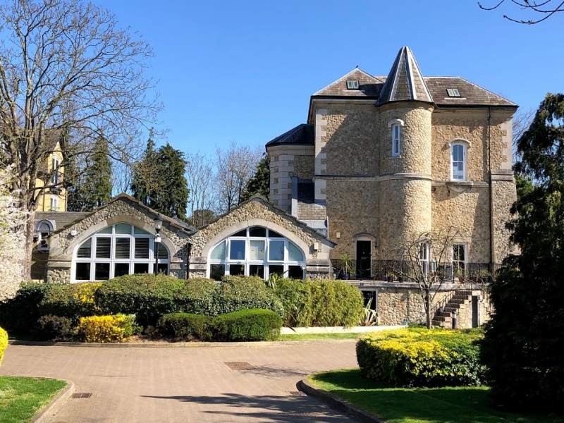
Late C19 to early C20 built of squared kentish ragstone blocks. 1 to 3 storeys.
The South West portion is of 3 storeys. Tiled roof buttresses. 4 metal framed
vertically opening casements. The ground floor windows have cambered architraves,
1st floor windows have flat architraves though some are round-headed in the side
elevation, the 2nd floor windows are lunettes. Attached to this is a 1 storey
portion with renewed tiled roof. Buttresses and 3 round-headed windows. Attached
to this on the South East side is a 1 storey portion with 2 gables containing
lancet windows and tall lunettes on the ground floor, Buttresses, Chimney
Listing NGR: TQ3950969106
External links are from the relevant listing authority and, where applicable, Wikidata. Wikidata IDs may be related buildings as well as this specific building. If you want to add or update a link, you will need to do so by editing the Wikidata entry.


Other nearby listed buildings
