Latitude: 51.2499 / 51°14'59"N
Longitude: 0.6514 / 0°39'4"E
OS Eastings: 585132
OS Northings: 153415
OS Grid: TQ851534
Mapcode National: GBR QSX.HJF
Mapcode Global: VHJMH.7VQ7
Plus Code: 9F326MX2+WH
Entry Name: Greenway Forstal Farmhouse
Listing Date: 26 April 1968
Last Amended: 14 December 1984
Grade: II*
Source: Historic England
Source ID: 1299691
English Heritage Legacy ID: 173780
ID on this website: 101299691
Location: Chegworth, Maidstone, Kent, ME17
County: Kent
District: Maidstone
Civil Parish: Harrietsham
Traditional County: Kent
Lieutenancy Area (Ceremonial County): Kent
Tagged with: Farmhouse
HARRIETSHAM GREENWAY FORSTAL TQ 85 SE 4/47 Greenway Forstal Farmhouse (formerly 26.4.68. listed as Greenway Forstal)
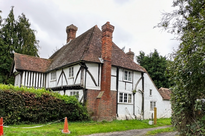
GV II* Farmhouse. Late C16 or early C17. Timber-framed with plaster infilling and plain tile roof. Approximately 4 timber-framed bays, with lobby entry 3rd bay from right. 2 storeys and attics on plinth, with continuous jetty. Left bay on ground floor close studded, rest broadly-spaced studding with tension braces. Steeply pitched roof, hipped to right. Attic jettied to left on moulded brackets, half-hipped above. Corbelled red brick ridge stack in 3rd bay from right,and small mid C19 chequered red and grey brick stack projecting to right end. One rear dormer. Irregular fenestration of 4 casements. 2-storey close-studded porch-cum- stair turret beneath stack with coved jettied gable on carved brackets with moulded bargeboards and pendant. Boarded door to right side of gable end of porch, probably original, in moulded architrave. Later rendered rear lean-to to right. Interior not inspected.
Listing NGR: TQ8513253415
External links are from the relevant listing authority and, where applicable, Wikidata. Wikidata IDs may be related buildings as well as this specific building. If you want to add or update a link, you will need to do so by editing the Wikidata entry.


Other nearby listed buildings