Latitude: 52.2632 / 52°15'47"N
Longitude: -1.8971 / 1°53'49"W
OS Eastings: 407119
OS Northings: 262788
OS Grid: SP071627
Mapcode National: GBR 3JG.15Y
Mapcode Global: VHB02.2CFW
Plus Code: 9C4W7473+75
Entry Name: The Barn
Listing Date: 23 October 1985
Grade: II
Source: Historic England
Source ID: 1299699
English Heritage Legacy ID: 305489
ID on this website: 101299699
Location: Middletown, Stratford-on-Avon, Warwickshire, B80
County: Warwickshire
District: Stratford-on-Avon
Civil Parish: Sambourne
Traditional County: Warwickshire
Lieutenancy Area (Ceremonial County): Warwickshire
Church of England Parish: Studley with Mappleborough Green
Church of England Diocese: Coventry
Tagged with: Barn
SAMBOURNE BROMSGROVE ROAD SP06SE (West side) 4/139 The Barn
- II
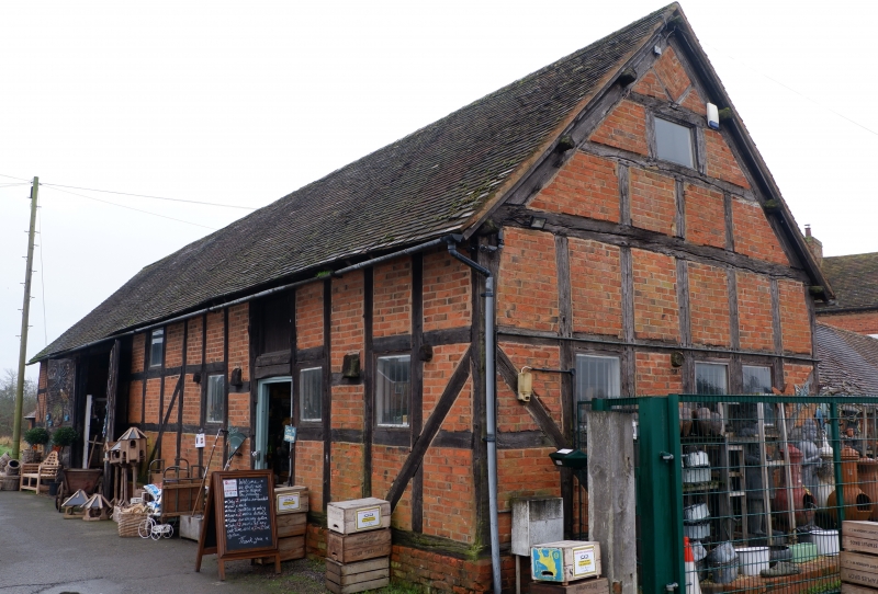
Barn and stable, now shop. C17, converted late C20. Timber framed: square framing with tension braces and brick infill. Tile roof. 3-bay barn, 2-bay stable. Barn has central plank doors, with shop front behind. Former stable doorway on right has half-glazed door. Adjacent window. Hayloft doorway boarded up. Small windows inserted into framing interstices. Return sides have jowled posts. Interior: Barn has retaining walls and diagonal braces. A floor and partition have been inserted, but these do not appear to have affected the structure.
Listing NGR: SP0711962788
External links are from the relevant listing authority and, where applicable, Wikidata. Wikidata IDs may be related buildings as well as this specific building. If you want to add or update a link, you will need to do so by editing the Wikidata entry.


Other nearby listed buildings