Latitude: 51.127 / 51°7'37"N
Longitude: 0.7552 / 0°45'18"E
OS Eastings: 592889
OS Northings: 140028
OS Grid: TQ928400
Mapcode National: GBR RWX.CQC
Mapcode Global: VHKKL.1XLW
Plus Code: 9F324QG4+R3
Entry Name: Laurel Cottage
Listing Date: 10 October 1980
Grade: II
Source: Historic England
Source ID: 1299815
English Heritage Legacy ID: 180595
ID on this website: 101299815
Location: Bethersden, Ashford, Kent, TN26
County: Kent
District: Ashford
Civil Parish: Bethersden
Built-Up Area: Bethersden
Traditional County: Kent
Lieutenancy Area (Ceremonial County): Kent
Tagged with: Cottage
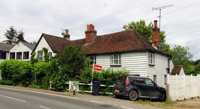
1.
5272 BETHERSDEN ASHFORD ROAD
Laurel Cottage
TQ 9240 21/68
II GV
2.
C18 or earlier timber-framed building. Two storeys weatherboarded. Steeply
pitched tiled roof, hipped at right-hand side. Four casements. Doorcase with
porch. On the left is a C19 addition also weatherboarded.
Listing NGR: TQ9289440029
External links are from the relevant listing authority and, where applicable, Wikidata. Wikidata IDs may be related buildings as well as this specific building. If you want to add or update a link, you will need to do so by editing the Wikidata entry.


Other nearby listed buildings