Approximate Location Map
Large Map »
Latitude: 51.1266 / 51°7'35"N
Longitude: 0.7561 / 0°45'21"E
OS Eastings: 592952
OS Northings: 139978
OS Grid: TQ929399
Mapcode National: GBR RWX.CZ6
Mapcode Global: VHKKL.2Y27
Plus Code: 9F324QG4+JC
Entry Name: Forge Dene
Listing Date: 10 October 1980
Grade: II
Source: Historic England
Source ID: 1362971
English Heritage Legacy ID: 180596
ID on this website: 101362971
Location: Bethersden, Ashford, Kent, TN26
County: Kent
District: Ashford
Civil Parish: Bethersden
Built-Up Area: Bethersden
Traditional County: Kent
Lieutenancy Area (Ceremonial County): Kent
Tagged with: Architectural structure
1.
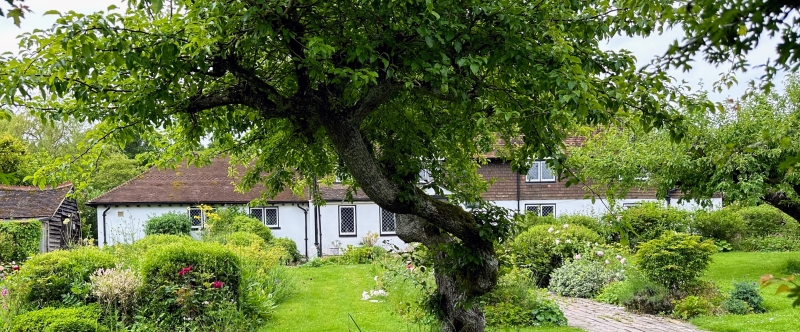
5272 BETHERSDEN ASHFORD ROAD
Forge Dene
TQ 9239 21/18
II
2.
Late mediaeval timber-framed building, refaced in C19 with stucco on the ground
floor and tile-hung above. Steeply-pitched hipped tiled roof with C17 chimney
stack and one dormer. Four casement windows. Small C19 gables added above
the 1st floor windows.
Listing NGR: TQ9295539975
External links are from the relevant listing authority and, where applicable, Wikidata. Wikidata IDs may be related buildings as well as this specific building. If you want to add or update a link, you will need to do so by editing the Wikidata entry.


Other nearby listed buildings
