Latitude: 53.8633 / 53°51'47"N
Longitude: -1.8423 / 1°50'32"W
OS Eastings: 410470
OS Northings: 440796
OS Grid: SE104407
Mapcode National: GBR HRKR.YV
Mapcode Global: WHC91.N5Y5
Plus Code: 9C5WV575+83
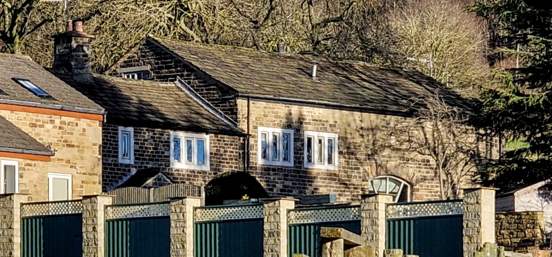
Entry Name: Laythorpe Farmhouse and Attached Barn
Listing Date: 18 October 1985
Grade: II
Source: Historic England
Source ID: 1300984
English Heritage Legacy ID: 337989
ID on this website: 101300984
Location: Crossflatts, Bradford, West Yorkshire, BD16
County: Bradford
Civil Parish: Bingley
Built-Up Area: Bingley
Traditional County: Yorkshire
Lieutenancy Area (Ceremonial County): West Yorkshire
Church of England Parish: Bingley All Saints
Church of England Diocese: Leeds
Tagged with: Farmhouse
SE14SW BINGLEY MICKLETHWAITE LANE SE104408 (east side)
2/136 Laythorpe Farmhouse and attached barn
II
House and attached. barn. Initialled and dated " R L 1737 ", barn added slightly later. Hammer-dressed stone, dressed quoins, stone slate roof. 2 storeys. House: 2-cell central lobby-entry plan, double-depth. Three lst-floor windows. Doorway with chamfered monolithic jambs, the lintel inscribed with date, masked by late C20 open gabled porch. Single-light window above. To either side on both floors a 3-light flat-faced mullioned window with slightly recessed mullions, ground-floor windows originally of 5 lights, 2 mullions removed, the remaining mullions moved to form 3 wide lights. Coped gable with kneelers to left. Central ridge stack with cyma-moulded cornice. 4-bay barn attached to right. Quoins to left. The 2 left bays now part of house with windows in keeping. Segmental-arched cart entry with skewbacks, chamfered surround and composite jambs. Roof raised when windows inserted.
Listing NGR: SE1047040796
External links are from the relevant listing authority and, where applicable, Wikidata. Wikidata IDs may be related buildings as well as this specific building. If you want to add or update a link, you will need to do so by editing the Wikidata entry.


Other nearby listed buildings