Approximate Location Map
Large Map »
Latitude: 54.3763 / 54°22'34"N
Longitude: -2.1392 / 2°8'21"W
OS Eastings: 391055
OS Northings: 497880
OS Grid: SD910978
Mapcode National: GBR FKHT.NZ
Mapcode Global: WHB58.38LC
Plus Code: 9C6V9VG6+G8
Entry Name: Church of Saint Mary
Listing Date: 7 December 1966
Grade: II*
Source: Historic England
Source ID: 1302046
English Heritage Legacy ID: 322232
ID on this website: 101302046
Location: St Mary's Church, Muker, North Yorkshire, DL11
County: North Yorkshire
District: Richmondshire
Civil Parish: Muker
Traditional County: Yorkshire
Lieutenancy Area (Ceremonial County): North Yorkshire
Tagged with: Church building
SD 99 NW MUKER MUKER
14/147 Church of Saint Mary
7.12.66
GV II *
Church. 1580, C18, restored 1891. Rubble, stone slate roof. West tower,
nave and chancel under 1 roof, south porch. Tower: possibly 1580. 3
stages. Quoins. On ground floor, a vent with vertical iron bar. 2-light
chamfered-mullion belfry openings. Bench-mark on west face. Lead rainwater
head cast with "R METCALFE, I CALVERT, C-WARDENS 1793". Porch: dated 1849
on kneeler. Coursed stone. Sundial. Inner doorway: 4-centred arch,
chamfered, with inscription "LW 1719 IP". Nave and chancel: substantially
of 1580. 3 and 2 bays. 2-light chamfered-mullion window to south-west.
Other windows C19, of 2 trefoil-headed lights with hoodmoulds. East window:
3 trefoil-headed lights under hoodmould. North side has C18 lead rainwater
head. Interior: beaded wall plate and roof timbers substantially of 1580,
but raised from steeper thatched pitch in 1761. Font: C19, round basin on
cylindrical shaft and base. On south wall of sanctuary, a small stone
inscribed "SG 1769". Against north wall of sanctuary, vertical slab
commemorating Mr James of the parish of Redrith, Cornwall, d.1746. South
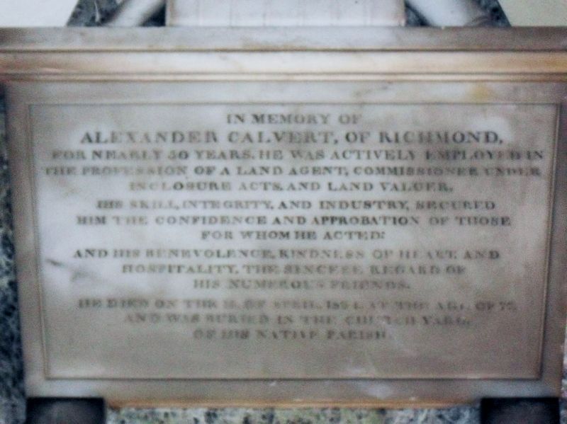
wall of chancel, memorial to Alexander Calvert of Richmond, land agent and
commissioner under Inclosure Acts, d.1834. North wall of nave, memorial to
Edmund Alderson Knowles of Low Row d.1835 by G Green, Newcastle, and board
painted with rules for use of Parish Hearse, 1836. A rare example of a new
church in 1580. E Cooper, Muker: The Story of a Yorkshire Parish (1948).
Listing NGR: SD9105597880
External links are from the relevant listing authority and, where applicable, Wikidata. Wikidata IDs may be related buildings as well as this specific building. If you want to add or update a link, you will need to do so by editing the Wikidata entry.


Other nearby listed buildings
