Latitude: 54.3763 / 54°22'34"N
Longitude: -2.1393 / 2°8'21"W
OS Eastings: 391051
OS Northings: 497873
OS Grid: SD910978
Mapcode National: GBR FKHT.NZ
Mapcode Global: WHB58.38KD
Plus Code: 9C6V9VG6+G7
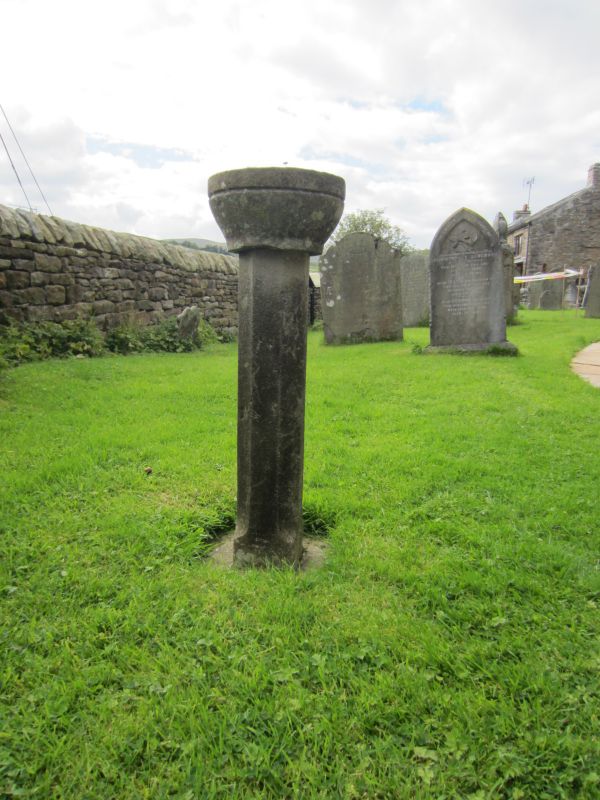
Entry Name: Old Font Approximately 3 Metres South of Porch of Church of Saint Mary
Listing Date: 5 September 1986
Grade: II
Source: Historic England
Source ID: 1317105
English Heritage Legacy ID: 322233
ID on this website: 101317105
Location: Muker, North Yorkshire, DL11
County: North Yorkshire
District: Richmondshire
Civil Parish: Muker
Traditional County: Yorkshire
Lieutenancy Area (Ceremonial County): North Yorkshire
Tagged with: Architectural structure Baptismal font
SD 99 NW
14/148
MUKER
MUKER
Old Font approximately 3 metres south of porch of Church of Saint Mary
GV
II
Old font. Perhaps of 1580. Stone. Square base supporting octagonal shaft
approximately 1 metre high, surmounted by small circular bowl.
Listing NGR: SD9105197873
External links are from the relevant listing authority and, where applicable, Wikidata. Wikidata IDs may be related buildings as well as this specific building. If you want to add or update a link, you will need to do so by editing the Wikidata entry.


Other nearby listed buildings