Latitude: 50.9493 / 50°56'57"N
Longitude: -2.5052 / 2°30'18"W
OS Eastings: 364605
OS Northings: 116770
OS Grid: ST646167
Mapcode National: GBR MV.NH3X
Mapcode Global: FRA 56ML.RTT
Plus Code: 9C2VWFXV+PW
Entry Name: Lattice House Including Area Railings
Listing Date: 28 November 1950
Grade: II
Source: Historic England
Source ID: 1304951
English Heritage Legacy ID: 103867
ID on this website: 101304951
Location: Sherborne, Dorset, DT9
County: Dorset
Civil Parish: Sherborne
Built-Up Area: Sherborne
Traditional County: Dorset
Lieutenancy Area (Ceremonial County): Dorset
Church of England Parish: Sherborne with Castleton Abbey Church of St Mary
Church of England Diocese: Salisbury
Tagged with: Building
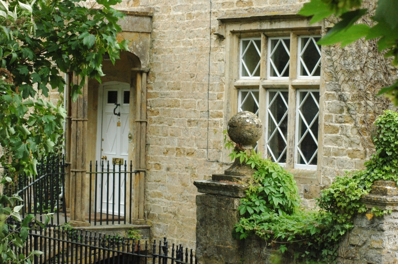
CASTLETON ROAD 1. 1625 - (South Side) ST 6416 2/259 28.11.50. lattice House including area railings II GV 2. The detail seems to be C18 to early C19 Gothic Revival but the house probably has an early C18 or C17 origin. 3 window stone front, 2 storeys, basement and attics. Slate roof. Parapet. Three lead-covered dormers with segmental heads. Stone mullioned and transomed windows. All windows, including dormers, have diagonal glazing bars. Projecting porch has Tudor arches and clustered shaft supports; flight of steps flanked by railings leads up To porch. Late C18 to Cl9 railings; standards at intervals with urn finials.
Church of St Mary Magdalene, Churchyard walls, piers and gates, Lattice House, Garden Wall and piers to Lattice House, Middle House and Raleigh Lodge form a group with the gates at the entrance to Sherborne Castle in Sherborne Rural District.
Listing NGR: ST6460716763
External links are from the relevant listing authority and, where applicable, Wikidata. Wikidata IDs may be related buildings as well as this specific building. If you want to add or update a link, you will need to do so by editing the Wikidata entry.


Other nearby listed buildings