Approximate Location Map
Large Map »
Latitude: 54.1871 / 54°11'13"N
Longitude: -3.1311 / 3°7'52"W
OS Eastings: 326284
OS Northings: 477404
OS Grid: SD262774
Mapcode National: GBR 6NK0.XT
Mapcode Global: WH72B.W05X
Plus Code: 9C6R5VP9+RG
Entry Name: Sundial Approximately 12.5 Metres South of St Michael's Church
Listing Date: 5 March 1990
Grade: II
Source: Historic England
Source ID: 1311419
English Heritage Legacy ID: 75877
ID on this website: 101311419
Location: St Michael's and the Holy Angels Church, Pennington, Westmorland and Furness, Cumbria, LA12
County: Cumbria
District: South Lakeland
Civil Parish: Pennington
Traditional County: Lancashire
Lieutenancy Area (Ceremonial County): Cumbria
Church of England Parish: Pennington St Michael and the Holy Angels
Church of England Diocese: Carlisle
Tagged with: Sundial
PENNINGTON
SD 27 NE
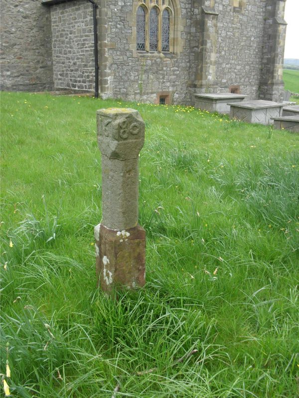
16/103 Sundial approx 12.5m south
of St Michael's Church (q.v.)
G.V. II
Sundial. 1680. Octagonal post with stop chamfers on tall square base.
Square cap has date: 1680 to west and south. No plate.
Listing NGR: SD2628477404
External links are from the relevant listing authority and, where applicable, Wikidata. Wikidata IDs may be related buildings as well as this specific building. If you want to add or update a link, you will need to do so by editing the Wikidata entry.


Other nearby listed buildings
