Latitude: 53.8474 / 53°50'50"N
Longitude: -1.8578 / 1°51'28"W
OS Eastings: 409449
OS Northings: 439027
OS Grid: SE094390
Mapcode National: GBR HRGY.LK
Mapcode Global: WHC91.FKJC
Plus Code: 9C5WR4WR+XV
Entry Name: The Stable Block Used by Turf Research Institute
Listing Date: 18 October 1985
Grade: II
Source: Historic England
Source ID: 1314301
English Heritage Legacy ID: 338049
ID on this website: 101314301
Location: Bradford, West Yorkshire, BD16
County: Bradford
Civil Parish: Harden
Traditional County: Yorkshire
Lieutenancy Area (Ceremonial County): West Yorkshire
Church of England Parish: Harden
Church of England Diocese: Leeds
Tagged with: Stable
BINGLEY ST. IVES ESTATE SE03NE SE092389 5/185 The Stable Block used by Turf Research Institute
II
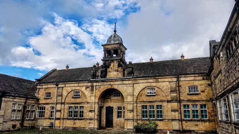
Stable block, now converted to offices, laboratory and garage. Initialled and dated " F " W-F (William and Fanny Ferrand) 1900
Hammer-dressed stone,ashlar-dressing, slate roof, one and 2 storeys. V-shaped with impressive central block: 2-storey 5-bay symmetrical facade with banded pilasters set between bays. Central 3 bays have raised semicircular archways in which are set 3-light ground-floor windows to 2nd and 4th bays. All bays have lst-floor window with segmental lintel with false ogee lintels to openings and domed cap. Wings have coped gables with kneelers and finials. That to right has datestone in blind arch over 4-light flat-faced mullioned window. Cross of the Knights Templars set in apex of gable, probably C17 and re-used. Wing to left is single-storey.
Listing NGR: SE0944939027
External links are from the relevant listing authority and, where applicable, Wikidata. Wikidata IDs may be related buildings as well as this specific building. If you want to add or update a link, you will need to do so by editing the Wikidata entry.


Other nearby listed buildings