Latitude: 54.4248 / 54°25'29"N
Longitude: -1.5288 / 1°31'43"W
OS Eastings: 430671
OS Northings: 503364
OS Grid: NZ306033
Mapcode National: GBR KKR8.TL
Mapcode Global: WHC6H.H17Q
Plus Code: 9C6WCFFC+WF
Entry Name: The Vicarage
Listing Date: 31 March 1970
Grade: II
Source: Historic England
Source ID: 1315472
English Heritage Legacy ID: 332050
ID on this website: 101315472
Location: East Cowton, North Yorkshire, DL7
County: North Yorkshire
District: Hambleton
Civil Parish: East Cowton
Built-Up Area: East Cowton
Traditional County: Yorkshire
Lieutenancy Area (Ceremonial County): North Yorkshire
Tagged with: Clergy house
NORTH YORKSHIRE HAMBLETON 5337 NZ 30 SW EAST COWTON HIGH STREET (west side) 3/6 The Vicarage
II 31.3.70
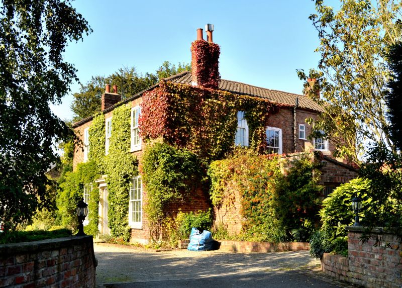
Vicarage. Early C19. Red brick in Flemish bond. Concrete tile roof. 2 storeys, 3 bays. Central 4-panel door and overlight with glazing bars in panelled reveal. Door surround of attached Doric columns, frieze, cornice, and blocking course. All windows have modern casements with flat brick arches. Hipped roof with end stacks.
Listing NGR: NZ3067103364
External links are from the relevant listing authority and, where applicable, Wikidata. Wikidata IDs may be related buildings as well as this specific building. If you want to add or update a link, you will need to do so by editing the Wikidata entry.


Other nearby listed buildings