Latitude: 51.1697 / 51°10'10"N
Longitude: -1.779 / 1°46'44"W
OS Eastings: 415548
OS Northings: 141185
OS Grid: SU155411
Mapcode National: GBR 503.M16
Mapcode Global: VHB5C.3VWP
Plus Code: 9C3W569C+VC
Entry Name: Old Viney's Farmhouse
Listing Date: 10 January 1953
Grade: II
Source: Historic England
Source ID: 1318493
English Heritage Legacy ID: 321375
ID on this website: 101318493
Location: Amesbury, Wiltshire, SP4
County: Wiltshire
Civil Parish: Amesbury
Built-Up Area: Amesbury
Traditional County: Wiltshire
Lieutenancy Area (Ceremonial County): Wiltshire
Church of England Parish: Amesbury St Mary and St Melor
Church of England Diocese: Salisbury
Tagged with: Farmhouse
AMESBURY SALISBURY ROAD SU 1541 (west side)
11/64 Old Viney's Farmhouse 10.1.53
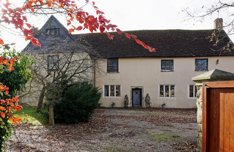
II Farmhouse, now dwelling and shop. Mid C16. Brick and flint with stone quoins, rendered to front. Tiled roof. Two storeys, 3 bays, with 2-bay cross wing at south-east end. Entrance to main living room in southerly of 3 main bays. Boarded door in stone surround with a reserve chamfered pointed arch cut back to a simple chamfer. Ground floor windows are 3-light stone mullioned with recessed reserve chamfers. First floor has 16-paned and 12-paned single hung sashes. Cross wing is of 2 bays, now opened up on ground floor. Similar 16-paned sashes. Single storey brick and tiled additions at both ends. External stacks to rear wall and to left end wall of wing, brick with two diagonally set brick shafts. Interior: Main living hall has stone fireplace on rear wall, with a four-centred chamfered arch. Chamfered spine beams. Right end bay originally service room, has open gable fireplace with timber lintel.
Listing NGR: SU1554841185
External links are from the relevant listing authority and, where applicable, Wikidata. Wikidata IDs may be related buildings as well as this specific building. If you want to add or update a link, you will need to do so by editing the Wikidata entry.


Other nearby listed buildings