Latitude: 53.2394 / 53°14'22"N
Longitude: -2.9935 / 2°59'36"W
OS Eastings: 333793
OS Northings: 371840
OS Grid: SJ337718
Mapcode National: GBR 7ZJZ.QG
Mapcode Global: WH87Z.ZTPY
Plus Code: 9C5V62Q4+QJ
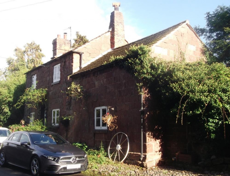
Entry Name: Stone Cottage and Attached Outbuilding and Boundary Wall
Listing Date: 1 June 1967
Grade: II
Source: Historic England
Source ID: 1318890
English Heritage Legacy ID: 55684
ID on this website: 101318890
Location: Shotwick, Cheshire West and Chester, Cheshire, CH1
County: Cheshire West and Chester
Civil Parish: Puddington
Traditional County: Cheshire
Lieutenancy Area (Ceremonial County): Cheshire
Church of England Parish: Shotwick St Michael
Church of England Diocese: Chester
Tagged with: Cottage
SJ 37 SW SHOTWICK C.P. THE VILLAGE (South Side)
3/38 Stone Cottage and attached outbuilding and boundary wall. 1/6/1967 - GV II
House, shippon and garden wall: early-mid C19. Ashlar red sandstone, concrete tile roof, 1 stone and 1 brick gable chimney. 1 and 2 storey, 4-bay front. House is symmetrical with C20, 2-light wooden casements under heavy lintels with faint channelling. Semi-circular headed doorcase with moulded imposts contains blocked fanlight, and partly glazed door approached by 3 stone steps. To right is lower shippon with central board door with strap hinges approached by 2 stone steps. Against the right end is a Welsh slated lean-to from which a tall stone wall with rounded coping, turns to form boundary with Manor Farm.
Listing NGR: SJ3379371840
External links are from the relevant listing authority and, where applicable, Wikidata. Wikidata IDs may be related buildings as well as this specific building. If you want to add or update a link, you will need to do so by editing the Wikidata entry.


Other nearby listed buildings