Latitude: 51.4016 / 51°24'5"N
Longitude: -1.4471 / 1°26'49"W
OS Eastings: 438558
OS Northings: 167102
OS Grid: SU385671
Mapcode National: GBR 70H.0YZ
Mapcode Global: VHC20.V1VB
Plus Code: 9C3WCH23+M5
Entry Name: Bridge over Mill Race
Listing Date: 21 June 1984
Grade: II
Source: Historic England
Source ID: 1319544
English Heritage Legacy ID: 39752
ID on this website: 101319544
Location: Kintbury, West Berkshire, RG17
County: West Berkshire
Civil Parish: Kintbury
Built-Up Area: Kintbury
Traditional County: Berkshire
Lieutenancy Area (Ceremonial County): Berkshire
Church of England Parish: Kintbury
Church of England Diocese: Oxford
Tagged with: Bridge
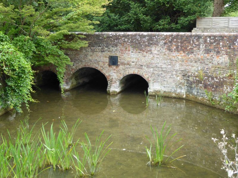
SU 36 NE KINTBURY STATION ROAD
12/23 Bridge over Mill Race
II
Road Bridge. Early C19. Brick. 3 arches with brick cutwaters.
Listing NGR: SU3855867102
External links are from the relevant listing authority and, where applicable, Wikidata. Wikidata IDs may be related buildings as well as this specific building. If you want to add or update a link, you will need to do so by editing the Wikidata entry.


Other nearby listed buildings