Approximate Location Map
Large Map »
Latitude: 52.1807 / 52°10'50"N
Longitude: -2.1145 / 2°6'52"W
OS Eastings: 392266
OS Northings: 253614
OS Grid: SO922536
Mapcode National: GBR 2HT.66X
Mapcode Global: VH92W.9GH3
Plus Code: 9C4V5VJP+75
Entry Name: Hunters Hill
Listing Date: 3 August 1972
Grade: II
Source: Historic England
Source ID: 1319713
English Heritage Legacy ID: 442617
ID on this website: 101319713
Location: Churchill, Wychavon, Worcestershire, WR7
County: Worcestershire
District: Wychavon
Civil Parish: Churchill
Traditional County: Worcestershire
Lieutenancy Area (Ceremonial County): Worcestershire
Church of England Parish: White Ladies Aston with Churchill and Spetchley
Church of England Diocese: Worcester
Tagged with: Architectural structure
CHURCHILL CHURCHILL
1.
2301
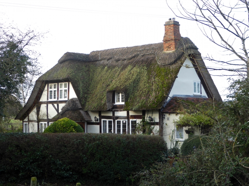
Hunters Hill
SO 95 SW 5/207
II
2.
Late C16. Timber frame and plaster and whitened brick with thatch. 1-storey
and attics. Half hipped gable facing front. Picturesque.
Listing NGR: SO9226653614
External links are from the relevant listing authority and, where applicable, Wikidata. Wikidata IDs may be related buildings as well as this specific building. If you want to add or update a link, you will need to do so by editing the Wikidata entry.


Other nearby listed buildings
