Approximate Location Map
Large Map »
Latitude: 52.1841 / 52°11'2"N
Longitude: -2.1072 / 2°6'25"W
OS Eastings: 392770
OS Northings: 253986
OS Grid: SO927539
Mapcode National: GBR 2HT.22F
Mapcode Global: VH92W.FCDJ
Plus Code: 9C4V5VMV+J4
Entry Name: Churchill Mill
Listing Date: 3 August 1972
Grade: II
Source: Historic England
Source ID: 1319714
English Heritage Legacy ID: 442619
ID on this website: 101319714
Location: Broughton Hackett, Wychavon, Worcestershire, WR7
County: Worcestershire
District: Wychavon
Civil Parish: Churchill
Traditional County: Worcestershire
Lieutenancy Area (Ceremonial County): Worcestershire
Church of England Parish: White Ladies Aston with Churchill and Spetchley
Church of England Diocese: Worcester
Tagged with: Mill
CHURCHILL CHURCHILL
1.
2301
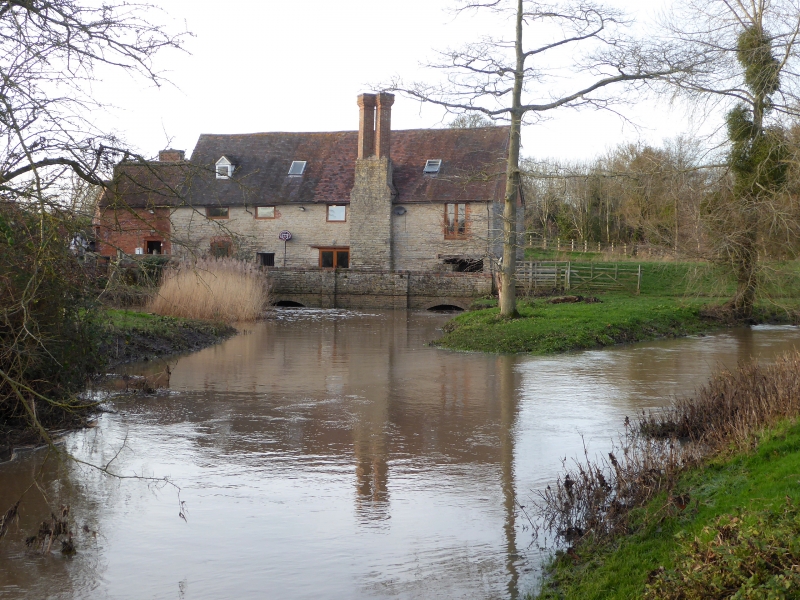
Churchill Mill
SO 95 SW 5/209
II
2.
C18 water mill, with earlier origin, converted to dwelling. Stone rubble.
Modern casements. 2-storeys. Gable ends. Tile roof. Machinery intact.
Possibly embodies earlier structure.
Listing NGR: SO9277053986
External links are from the relevant listing authority and, where applicable, Wikidata. Wikidata IDs may be related buildings as well as this specific building. If you want to add or update a link, you will need to do so by editing the Wikidata entry.


Other nearby listed buildings
