Approximate Location Map
Large Map »
Latitude: 51.7464 / 51°44'46"N
Longitude: -1.2563 / 1°15'22"W
OS Eastings: 451438
OS Northings: 205559
OS Grid: SP514055
Mapcode National: GBR 8Z4.F5X
Mapcode Global: VHCXV.5CPK
Plus Code: 9C3WPPWV+HF
Entry Name: Folly Bridge with Former Toll House
Listing Date: 12 January 1954
Grade: II
Source: Historic England
Source ID: 1319913
English Heritage Legacy ID: 245442
ID on this website: 101319913
Location: Grandpont, Oxford, Oxfordshire, OX1
County: Oxfordshire
District: Oxford
Electoral Ward/Division: Hinksey Park
Parish: Non Civil Parish
Built-Up Area: Oxford
Traditional County: Oxfordshire
Lieutenancy Area (Ceremonial County): Oxfordshire
Church of England Parish: Oxford St Aldate
Church of England Diocese: Oxford
Tagged with: Deck arch bridge
FOLLY BRIDGE
1.
1485
Folly Bridge, with
Former Toll-house
SP 5105 NW 12/598 12.1.54.
II
2.
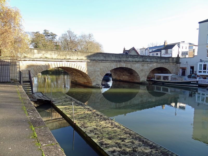
Rebuilt in 1826; on the North West corner is a contemporary l-storeyed stuccoed
toll house. An iron girder bridge was made over the South stream in 1888.
A very early river crossing, used by the Saxons and bridged by the Normans
in the late C11. The Saxon causeway has been discovered (1971) under St
Aldate's Street. The present bridge has a main span with 3 arches, and a
single subsidiary span to the South. Rusticated stone. The medieval bridge
was also known as "Friar Bacon's Bridge".
Listing NGR: SP5143805559
External links are from the relevant listing authority and, where applicable, Wikidata. Wikidata IDs may be related buildings as well as this specific building. If you want to add or update a link, you will need to do so by editing the Wikidata entry.


Other nearby listed buildings
