Latitude: 51.7468 / 51°44'48"N
Longitude: -1.2561 / 1°15'21"W
OS Eastings: 451455
OS Northings: 205608
OS Grid: SP514056
Mapcode National: GBR 8Z4.F7Y
Mapcode Global: VHCXV.5CT7
Plus Code: 9C3WPPWV+PH
Entry Name: Wharf House (North West Wing Only)
Listing Date: 1 December 1971
Grade: II
Source: Historic England
Source ID: 1348481
English Heritage Legacy ID: 245767
Also known as: Head of the River
ID on this website: 101348481
Location: Grandpont, Oxford, Oxfordshire, OX1
County: Oxfordshire
District: Oxford
Town: Oxford
Electoral Ward/Division: Holywell
Parish: Non Civil Parish
Built-Up Area: Oxford
Traditional County: Oxfordshire
Lieutenancy Area (Ceremonial County): Oxfordshire
Church of England Parish: Oxford St Aldate
Church of England Diocese: Oxford
Tagged with: House Architectural structure
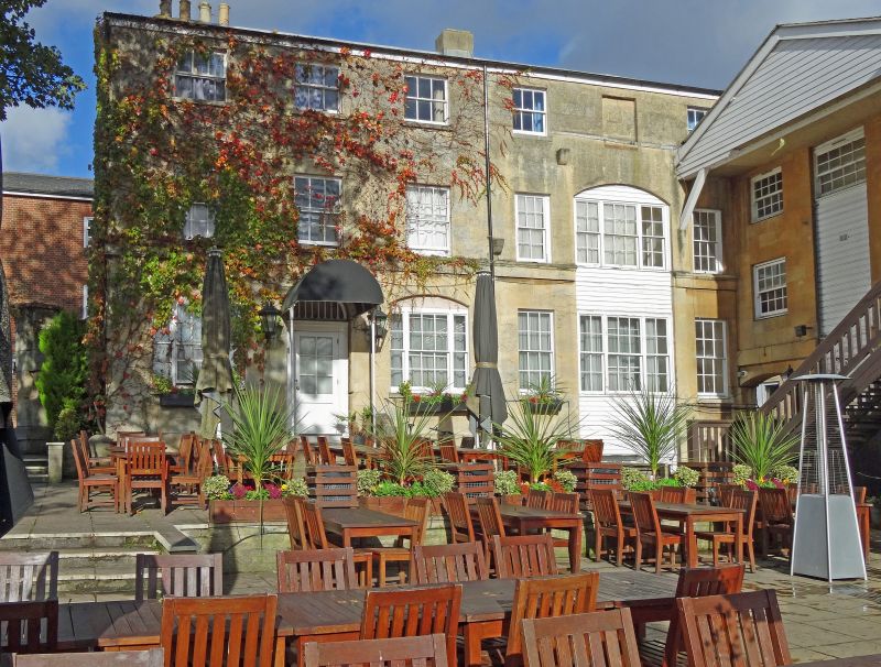
ST ALDATE'S STREET
1.
1485
(East Side)
Wharf House
(North-west wing only)
SP 5105 NW 12/816 1.12.71.
II
2.
Early Cl9. Brick, ashlar fronted. 3 storeys, 5 bays, 4 windows and door,
on the ground floor. 4-panelled door with semi-circular fanlight. Tripartite
sash either side of the door, the rest are sashes with glazing bars. Hipped
slate roof.
Listing NGR: SP5145505608
External links are from the relevant listing authority and, where applicable, Wikidata. Wikidata IDs may be related buildings as well as this specific building. If you want to add or update a link, you will need to do so by editing the Wikidata entry.


Other nearby listed buildings