Approximate Location Map
Large Map »
Latitude: 51.5384 / 51°32'18"N
Longitude: -2.3967 / 2°23'48"W
OS Eastings: 372579
OS Northings: 182240
OS Grid: ST725822
Mapcode National: GBR JZ.GCTV
Mapcode Global: VH95T.DLSJ
Plus Code: 9C3VGJQ3+98
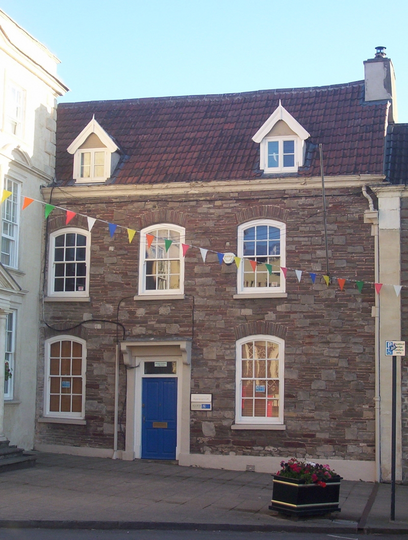
Entry Name: 3, High Street
Listing Date: 17 September 1952
Grade: II
Source: Historic England
Source ID: 1320900
English Heritage Legacy ID: 34098
ID on this website: 101320900
Location: Chipping Sodbury, South Gloucestershire, BS37
County: South Gloucestershire
Civil Parish: Sodbury
Built-Up Area: Chipping Sodbury
Traditional County: Gloucestershire
Lieutenancy Area (Ceremonial County): Gloucestershire
Church of England Parish: Chipping Sodbury St John the Baptist
Church of England Diocese: Gloucester
Tagged with: Building
ST 7282 SE SODBURY HIGH STREET
5/51 (north side)
17.9.52 No 3
GV
II
Mid-C18. Rubble. Double Roman tiled roof. 2½ storeys. Three windows, segmental
heads with glazing bar sashes. C19 dormers. Painted, moulded and coved, stone
cornice. Stone doorcase with flat stone hood on brackets.
Listing NGR: ST7257982240
External links are from the relevant listing authority and, where applicable, Wikidata. Wikidata IDs may be related buildings as well as this specific building. If you want to add or update a link, you will need to do so by editing the Wikidata entry.


Other nearby listed buildings
