Approximate Location Map
Large Map »
Latitude: 51.8858 / 51°53'8"N
Longitude: -0.521 / 0°31'15"W
OS Eastings: 501887
OS Northings: 221841
OS Grid: TL018218
Mapcode National: GBR G50.M43
Mapcode Global: VHFRC.XVFP
Plus Code: 9C3XVFPH+8H
Entry Name: 4, High Street South
Listing Date: 4 March 1976
Grade: II
Source: Historic England
Source ID: 1321397
English Heritage Legacy ID: 35754
ID on this website: 101321397
Location: Dunstable, Central Bedfordshire, LU6
County: Central Bedfordshire
Civil Parish: Dunstable
Built-Up Area: Dunstable
Traditional County: Bedfordshire
Lieutenancy Area (Ceremonial County): Bedfordshire
Church of England Parish: Dunstable
Church of England Diocese: St.Albans
Tagged with: Building
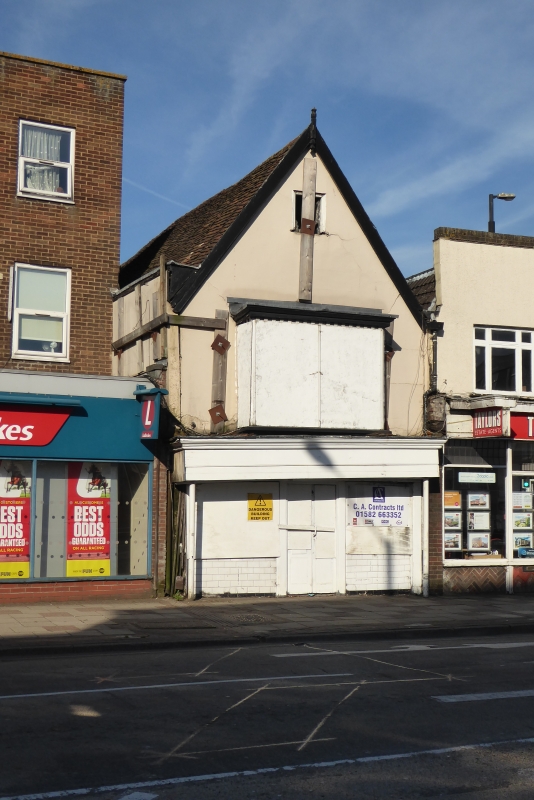
1. HIGH STREET SOUTH
(West Side)
No 4
TL 012l NE 1/23
II
2.
C17. Colour-washed plaster. White woodwork. Old tile roof with gable end to
street. 2 storeys and attics. Ground floor C19 shop, 1st floor 2-light sash.
Listing NGR: TL0188721841
External links are from the relevant listing authority and, where applicable, Wikidata. Wikidata IDs may be related buildings as well as this specific building. If you want to add or update a link, you will need to do so by editing the Wikidata entry.


Other nearby listed buildings
