Approximate Location Map
Large Map »
Latitude: 51.4548 / 51°27'17"N
Longitude: -0.9821 / 0°58'55"W
OS Eastings: 470822
OS Northings: 173361
OS Grid: SU708733
Mapcode National: GBR QJF.HX
Mapcode Global: VHDWS.XPNL
Plus Code: 9C3XF239+W5
Entry Name: 139 and 141, Oxford Road
Listing Date: 14 December 1978
Grade: II
Source: Historic England
Source ID: 1321910
English Heritage Legacy ID: 39094
ID on this website: 101321910
Location: Reading, Berkshire, RG1
County: Reading
Electoral Ward/Division: Abbey
Parish: Non Civil Parish
Built-Up Area: Reading
Traditional County: Berkshire
Lieutenancy Area (Ceremonial County): Berkshire
Church of England Parish: Reading Holy Trinity
Church of England Diocese: Oxford
Tagged with: Building
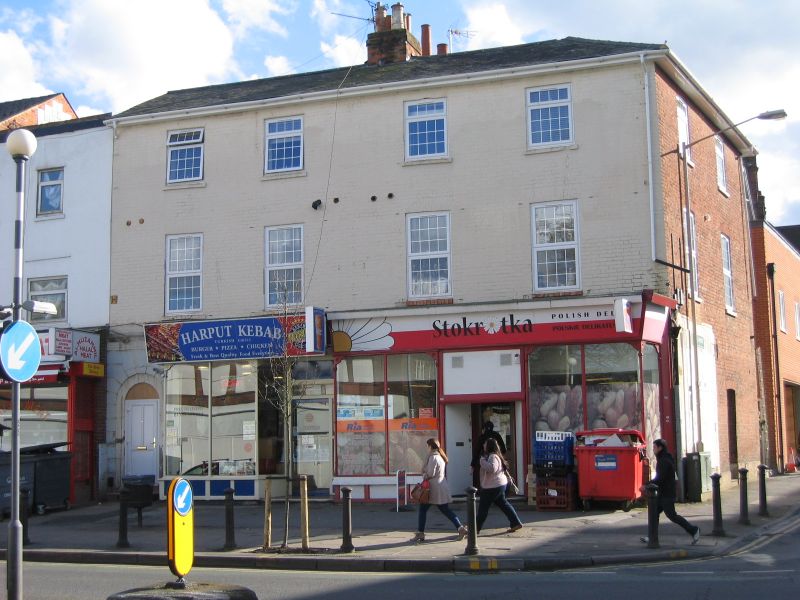
OXFORD ROAD
1.
5128
(South Side)
Nos 139 and 141
SU 7073 12/538
II GV
2.
Mid C19. 3 storeys painted brick. Slate roof with central chimney. 4 ranges
of glazing bar sash windows. Projecting modern shop front. To left is an
original doorway: round headed in channelled surround, 6 panels with circle
and teardrop fanlight.
Listing NGR: SU7082273361
External links are from the relevant listing authority and, where applicable, Wikidata. Wikidata IDs may be related buildings as well as this specific building. If you want to add or update a link, you will need to do so by editing the Wikidata entry.


Other nearby listed buildings
