Approximate Location Map
Large Map »
Latitude: 51.4552 / 51°27'18"N
Longitude: -0.9807 / 0°58'50"W
OS Eastings: 470919
OS Northings: 173409
OS Grid: SU709734
Mapcode National: GBR QJF.TS
Mapcode Global: VHDWS.YPD8
Plus Code: 9C3XF249+3P
Entry Name: Mannson House
Listing Date: 14 December 1978
Grade: II
Source: Historic England
Source ID: 1113549
English Heritage Legacy ID: 39104
ID on this website: 101113549
Location: Reading, Berkshire, RG1
County: Reading
Electoral Ward/Division: Abbey
Parish: Non Civil Parish
Built-Up Area: Reading
Traditional County: Berkshire
Lieutenancy Area (Ceremonial County): Berkshire
Church of England Parish: Reading Holy Trinity
Church of England Diocese: Oxford
Tagged with: House
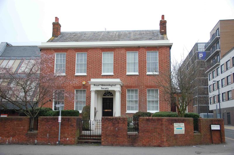
OXFORD ROAD
1.
5128
(North Side)
No 104
(Mannson on House)
SU 7073 12/219
II
2.
Early C19. 2 storeys. Red brick, small moulded stucco cornice and blocking.
course. Slate roof (hipped). Glazing bar sash windows, 5 on 1st floor, 4
on ground floor. Central Doric portico with moulded steps, arched fanlight
to 6 panelled door.
Listing NGR: SU7091973409
External links are from the relevant listing authority and, where applicable, Wikidata. Wikidata IDs may be related buildings as well as this specific building. If you want to add or update a link, you will need to do so by editing the Wikidata entry.


Other nearby listed buildings
