Approximate Location Map
Large Map »
Latitude: 50.2117 / 50°12'42"N
Longitude: -5.4793 / 5°28'45"W
OS Eastings: 151860
OS Northings: 40424
OS Grid: SW518404
Mapcode National: GBR DXV3.WH3
Mapcode Global: VH12D.ZY53
Plus Code: 9C2P6G6C+M7
Entry Name: Masonic Hall
Listing Date: 22 December 1972
Grade: II
Source: Historic England
Source ID: 1327778
English Heritage Legacy ID: 69082
ID on this website: 101327778
Location: St Ives, Cornwall, TR26
County: Cornwall
Civil Parish: St. Ives
Built-Up Area: St Ives
Traditional County: Cornwall
Lieutenancy Area (Ceremonial County): Cornwall
Church of England Parish: St Ives
Church of England Diocese: Truro
Tagged with: Masonic temple
This list entry was subject to a Minor Amendment on 23 August 2023 to amend the address and to reformat the text to current standards
SW 54 SW
1/128
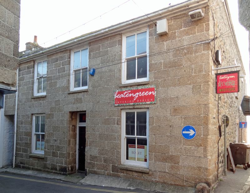
ST ANDREW'S STREET (East Side)
Masonic Hall
(Formerly listed as No 10 (Masonic Hall))
GV
II
Early C19. Granite ashlar, Two storeys. Three sash windows, no glazing bars. Central door, panelled, plain rectangular fanlight blocked. Slurried slate roof. Group value.
No 9 and Masonic Hall form a group.
Listing NGR: SW5186040424
External links are from the relevant listing authority and, where applicable, Wikidata. Wikidata IDs may be related buildings as well as this specific building. If you want to add or update a link, you will need to do so by editing the Wikidata entry.


Other nearby listed buildings
