Latitude: 50.2166 / 50°12'59"N
Longitude: -5.2423 / 5°14'32"W
OS Eastings: 168789
OS Northings: 40213
OS Grid: SW687402
Mapcode National: GBR Z3.FD0F
Mapcode Global: VH12K.2TY9
Plus Code: 9C2P6Q85+M3
Entry Name: Frue Vanner House to West Basset Stamps on North Wheal Basset Sett at SW 687 401
Listing Date: 12 September 1989
Grade: II
Source: Historic England
Source ID: 1328157
English Heritage Legacy ID: 66685
ID on this website: 101328157
Location: Carnkie, Cornwall, TR16
County: Cornwall
Civil Parish: Carn Brea
Traditional County: Cornwall
Lieutenancy Area (Ceremonial County): Cornwall
Church of England Parish: Redruth
Church of England Diocese: Truro
Tagged with: Architectural structure
CARN BREA CARNKIE SW 64 SE 5/137 Frue Vanner house to West Basset Stamps on North Wheal Basset sett at SW 687 401
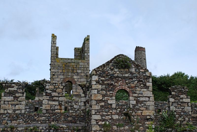
GV II Frue Vanner house at tin ore dressing plant of former West Basset Mine; now derelict. 1901-2. Killas rubble with granite quoins; now roofless. Long rectangular building on north-east/south-west axis parallel with former stamps on north-west side and overlooking dressing floor on south-east side, with small projecting engine house in the centre of that side. Single storey, 11 bays, symmetrical, with gabled engine house in centre of south-east side, large round-headed windows (mostly now with broken heads), and symmetrical 3-bay gable walls with central doorway flanked by windows and a third window over the door (west gable wall damaged). History: built on top of six former buddles to house 20 Frue vanner machines, as part of general improvements to West Basset Mines during a period of prosperity. Now the most impressive of the buildings on this site. Reference: Palmer & Neaverson The Basset Mines (1987).
Listing NGR: SW6870040100
External links are from the relevant listing authority and, where applicable, Wikidata. Wikidata IDs may be related buildings as well as this specific building. If you want to add or update a link, you will need to do so by editing the Wikidata entry.


Other nearby listed buildings