Latitude: 54.5244 / 54°31'27"N
Longitude: -1.2484 / 1°14'54"W
OS Eastings: 448744
OS Northings: 514603
OS Grid: NZ487146
Mapcode National: GBR MJQ3.JX
Mapcode Global: WHD75.SJQW
Plus Code: 9C6WGQF2+QJ
Entry Name: Stable and Cart Shed, Circa 20 Metres East of Hemlington Hall Farmhouse
Listing Date: 28 July 1988
Grade: II
Source: Historic England
Source ID: 1329513
English Heritage Legacy ID: 59766
ID on this website: 101329513
Location: Brookfield, Middlesbrough, North Yorkshire, TS8
County: Middlesbrough
Electoral Ward/Division: Hemlington
Parish: Non Civil Parish
Built-Up Area: Middlesbrough
Traditional County: Yorkshire
Lieutenancy Area (Ceremonial County): North Yorkshire
Church of England Parish: Hemlington St Timothy
Church of England Diocese: York
Tagged with: Stable
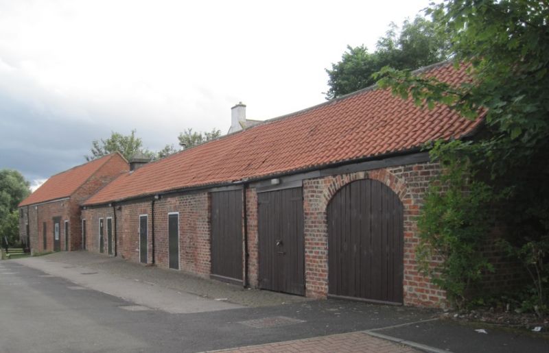
MIDDLESBROUGH NUNEATON DRIVE, NZ 41 SE (4814) south end (off), Hemlington 5/59 Stable and cart-shed, c.20m east of Hemlington Hall Farmhouse. G.V. II Stable and cart shed, early/mid C19 in 2 builds. Brick in English garden wall bond. Welsh slate roof; renewed clay pantiles on east side. Stone gable coping at north end. One storey. East face : 5 boarded doors at left end. Off-centre blocked window. 3 cart openings at right end, the right segment-headed, the left and right boarded up, the middle with boarded double doors. West face: off-centre boarded double doors in basket-arched opening with blocked tympanum. Right boarded door and window, with gauged brick flat arches. Late C20 door at right end. Included for group value. Barn adjoining south end too much altered to be of special interest.
Listing NGR: NZ4874414603
External links are from the relevant listing authority and, where applicable, Wikidata. Wikidata IDs may be related buildings as well as this specific building. If you want to add or update a link, you will need to do so by editing the Wikidata entry.


Other nearby listed buildings