Latitude: 53.1736 / 53°10'25"N
Longitude: -2.5887 / 2°35'19"W
OS Eastings: 360749
OS Northings: 364220
OS Grid: SJ607642
Mapcode National: GBR 7Q.41QB
Mapcode Global: WH99Q.6HKC
Plus Code: 9C5V5CF6+FG
Entry Name: Darley Hall Farmhouse
Listing Date: 12 March 1986
Grade: II
Source: Historic England
Source ID: 1329850
English Heritage Legacy ID: 57336
ID on this website: 101329850
Location: Cheshire West and Chester, Cheshire, CW6
County: Cheshire West and Chester
Civil Parish: Little Budworth
Traditional County: Cheshire
Lieutenancy Area (Ceremonial County): Cheshire
Church of England Parish: Over St Chad
Church of England Diocese: Chester
Tagged with: Farmhouse
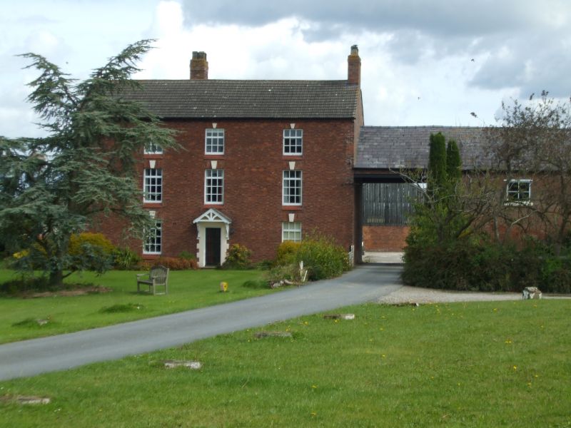
LITTLE BUDWORTH C.P. OULTON PARK SJ 66 SW 7/54 Darley Hall Farmhouse. - - II Farmhouse. C17 and early C18. Red Flemish bond brick with C20 pantile roof. Three storeys. T-shaped plan. Entrance front: being the cross-stroke of the T and of early C18 date later refaced. Three bays. Central doorway with C20 chamfered quoin surround with C20 glazed door. C19 gabled porch supported on brackets over windows to either side of 3 x 4 panes with C20 tile sills and wedged heads with keystones. Three similar windows to first floor and similar windows to second floor of 3 x 3 panes. Driftway and outhouse to right (not of special interest). Rear has projecting 2-storey wing to centre. Interior: Chamfered beams to kitchen with sandstone plinth evident and probable remnants of baffle entry plan. More chamfered beams to sitting room and bar.
Listing NGR: SJ6074964220
External links are from the relevant listing authority and, where applicable, Wikidata. Wikidata IDs may be related buildings as well as this specific building. If you want to add or update a link, you will need to do so by editing the Wikidata entry.


Other nearby listed buildings