Approximate Location Map
Large Map »
Latitude: 52.3964 / 52°23'46"N
Longitude: 0.2671 / 0°16'1"E
OS Eastings: 554348
OS Northings: 280012
OS Grid: TL543800
Mapcode National: GBR M6H.NBR
Mapcode Global: VHHJD.L118
Plus Code: 9F4297W8+GR
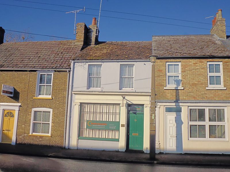
Entry Name: 54, Broad Street
Listing Date: 19 June 1972
Grade: II
Source: Historic England
Source ID: 1331694
English Heritage Legacy ID: 48673
ID on this website: 101331694
Location: Ely, East Cambridgeshire, CB7
County: Cambridgeshire
District: East Cambridgeshire
Civil Parish: Ely
Built-Up Area: Ely
Traditional County: Cambridgeshire
Lieutenancy Area (Ceremonial County): Cambridgeshire
Church of England Parish: Ely
Church of England Diocese: Ely
Tagged with: Building
1. BROADSTEET
1082
(North West Side)
TL 5479 2/106 No 54
II
2.
An early C19 stuccoed house and shop front. 2 storeys. 2 window range,
double-hung sashes with single vertical glazing bars. The ground storey
has a good early C19 shop front (now used as a domestic dwelling) with
Ionic pilasters and a cornice across the front. The window has glazing
bars. Roof slate.
Listing NGR: TL5434880012
External links are from the relevant listing authority and, where applicable, Wikidata. Wikidata IDs may be related buildings as well as this specific building. If you want to add or update a link, you will need to do so by editing the Wikidata entry.


Other nearby listed buildings
