Approximate Location Map
Large Map »
Latitude: 52.2066 / 52°12'23"N
Longitude: 0.1184 / 0°7'6"E
OS Eastings: 544851
OS Northings: 258602
OS Grid: TL448586
Mapcode National: GBR L79.LR9
Mapcode Global: VHHK3.0SGS
Plus Code: 9F426449+J9
Entry Name: 14, Trinity Street
Listing Date: 26 April 1950
Grade: II*
Source: Historic England
Source ID: 1331909
English Heritage Legacy ID: 47802
ID on this website: 101331909
Location: Cambridge, Cambridgeshire, CB2
County: Cambridgeshire
District: Cambridge
Electoral Ward/Division: Castle
Parish: Non Civil Parish
Built-Up Area: Cambridge
Traditional County: Cambridgeshire
Lieutenancy Area (Ceremonial County): Cambridgeshire
Church of England Parish: Cambridge St Mary the Great with St Michael
Church of England Diocese: Ely
Tagged with: Building
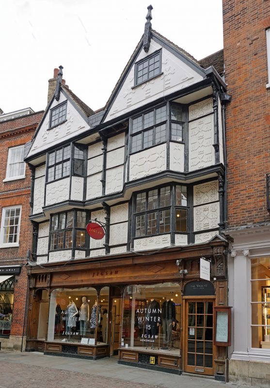
TRINITY STREET
1.
942
(East Side)
No 14
TL 4458 NE 3/180 26.4.50.
II* GV
2.
Late Cl6; timber-framed and plastered in 2 gabled bay, with projecting
upper floors and projecting gables with finials; bay windows on both upper
floors; bays divided by small pendant columns with carved brackets. Modern
shop front ground floor. The front has been restored and has modern pargetting.
The majority of the external carving has been restored. Tiled roof. (RCHM
108.)
Nos 9, 10, 13 to 17 (consec), 19 to 21 (consec), 23 and 24 form a group.
Listing NGR: TL4485158602
External links are from the relevant listing authority and, where applicable, Wikidata. Wikidata IDs may be related buildings as well as this specific building. If you want to add or update a link, you will need to do so by editing the Wikidata entry.


Other nearby listed buildings
