Latitude: 51.6513 / 51°39'4"N
Longitude: -0.7565 / 0°45'23"W
OS Eastings: 486123
OS Northings: 195450
OS Grid: SU861954
Mapcode National: GBR D4Y.FJN
Mapcode Global: VHDVY.TRXJ
Plus Code: 9C3XM62V+G9
Entry Name: Stable Block and Attached Garden Walls at Hughenden Manor
Listing Date: 4 July 1985
Grade: II
Source: Historic England
Source ID: 1332071
English Heritage Legacy ID: 46569
ID on this website: 101332071
Location: Buckinghamshire, HP14
County: Buckinghamshire
Civil Parish: Hughenden
Traditional County: Buckinghamshire
Lieutenancy Area (Ceremonial County): Buckinghamshire
Church of England Parish: Hughenden
Church of England Diocese: Oxford
Tagged with: Stable
HUGHENDEN HUGHENDEN PARK SU 89 NE
4/89 Stable block and attached garden walls at Hughenden - Manor
- II
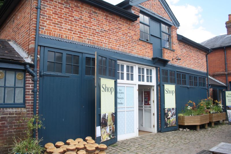
Stable block, now garages, shop and dwelling, with walls surrounding former kitchen garden to east. Late C19, probably by E.B. Lamb. Stables are of red brick with hipped slate roofs. Courtyard plan with 2-storey house at N. end, 5-bay coach-house to W., garages to E, and gatehouse to S. House has irregular sash windows and central archway. Coach-house has central gabled loft entry. More elaborate gatehouse has stepped parapet with brick cogging, stone coping and central ogee finial. Off-set and dentilled cornice below. Central shaped wooden gates in double chamfered segmental arch with keyblock. Flanking bays are set slightly back and have single lights with keyblocks and pendants. To right is brick garden wall stepped down in 3 stages to gateway at angle. This gateway has matching stepped parapet, and double gates in segmental arch of 2 orders. Re-sited stone sundial dated 1749. Remainder of wall is of flint and brick.
Listing NGR: SU8612395450
External links are from the relevant listing authority and, where applicable, Wikidata. Wikidata IDs may be related buildings as well as this specific building. If you want to add or update a link, you will need to do so by editing the Wikidata entry.


Other nearby listed buildings