Approximate Location Map
Large Map »
Latitude: 51.6481 / 51°38'53"N
Longitude: -0.7625 / 0°45'45"W
OS Eastings: 485713
OS Northings: 195097
OS Grid: SU857950
Mapcode National: GBR D4Y.L19
Mapcode Global: VHDVY.QTQX
Plus Code: 9C3XJ6XP+7X
Entry Name: Barn West of Hughenden Manor Farmhouse
Listing Date: 28 June 1973
Grade: II
Source: Historic England
Source ID: 1332347
English Heritage Legacy ID: 46003
ID on this website: 101332347
Location: Downley, Buckinghamshire, HP13
County: Buckinghamshire
Electoral Ward/Division: Disraeli
Parish: Non Civil Parish
Traditional County: Buckinghamshire
Lieutenancy Area (Ceremonial County): Buckinghamshire
Church of England Parish: Hughenden
Church of England Diocese: Oxford
Tagged with: Barn
COATES LANE
1.
963
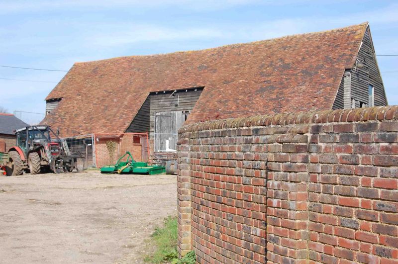
Barn West of
Hughenden Manor Farmhouse
SU 89 NE 8/234
II GV
C17 or C18. Weatherboarding, old tiles, T plan.
Hughenden Manor Farmhouse and Barns form a group.
Listing NGR: SU8571395097
External links are from the relevant listing authority and, where applicable, Wikidata. Wikidata IDs may be related buildings as well as this specific building. If you want to add or update a link, you will need to do so by editing the Wikidata entry.


Other nearby listed buildings
