Latitude: 52.8585 / 52°51'30"N
Longitude: -1.3708 / 1°22'14"W
OS Eastings: 442460
OS Northings: 329181
OS Grid: SK424291
Mapcode National: GBR 7H3.VMF
Mapcode Global: WHDH7.XDDZ
Plus Code: 9C4WVJ5H+9M
Entry Name: Trent and Mersey Canal Aston Lock and Aston Lock Bridge
Listing Date: 11 March 1987
Grade: II
Source: Historic England
Source ID: 1334603
English Heritage Legacy ID: 82995
ID on this website: 101334603
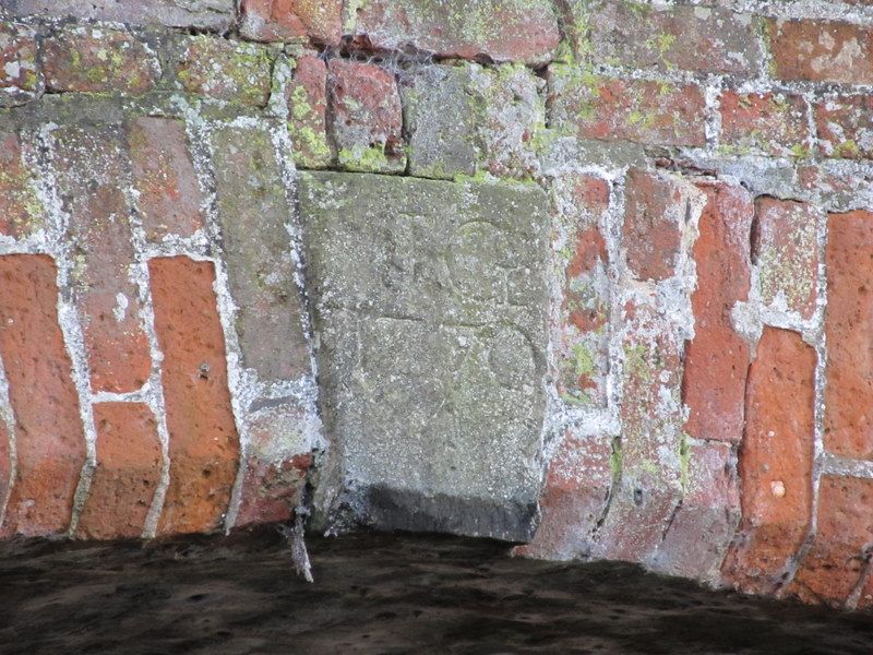
SK 42 NW PARISH OF ASTON-UPON-TRENT SHARDLOW ROAD 4/10 (East Side) Aston Lock and Aston Lock Bridge II Lock, gates, leat and canal bridge. 1770, by engineer James Brindley, with later rebuilding . Red brick chamber, partly rebuilt in blue brick, with stone and concrete copings, plus metal and wooden gates, and red brick bridge with stone dressings. Chamber is approximately 12 feet deep and has been largely rebuilt to west side. To either side there are small metal bollards and east side has C20 steps to centre. Both sets of gates have wooden frames with metal plates attached and metal balance beams, weighted with concrete, also with concrete semi-circles plus brick steps to either side. South gates have rack and pinion paddle mechanisms and iron handrails. Northern gates have barrel gearing. Leat runs to west side of the chamber. Bridge to north end has single segmental brick arch on tapering stone and blue brick jambs. North side has stone keyblock inscribed 'JB 1770'. Plain parapets over have chamfered stone copings and the walls curve outwards to each end, finishing in square piers. South side of bridge has small C20 metal bridge attached. Built as part of the Trent and Mersey Canal.
Listing NGR: SK4246029181
External links are from the relevant listing authority and, where applicable, Wikidata. Wikidata IDs may be related buildings as well as this specific building. If you want to add or update a link, you will need to do so by editing the Wikidata entry.


Other nearby listed buildings