Latitude: 53.0854 / 53°5'7"N
Longitude: -1.5726 / 1°34'21"W
OS Eastings: 428726
OS Northings: 354329
OS Grid: SK287543
Mapcode National: GBR 59G.K7L
Mapcode Global: WHCDV.TQB0
Plus Code: 9C5W3CPG+5X
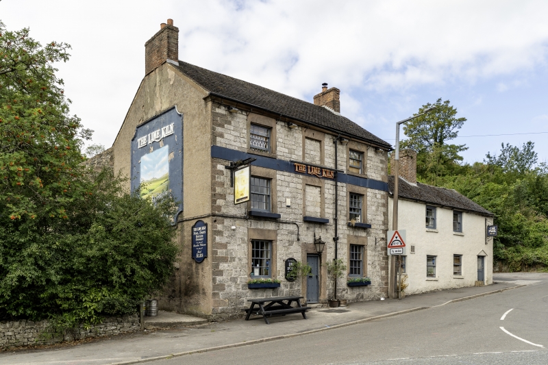
Entry Name: Lime Kiln Inn
Listing Date: 23 January 1973
Grade: II
Source: Historic England
Source ID: 1335123
English Heritage Legacy ID: 79748
Also known as: Lime Kiln, Matlock
Lime Kiln
ID on this website: 101335123
Location: Wirksworth, Derbyshire Dales, Derbyshire, DE4
County: Derbyshire
District: Derbyshire Dales
Civil Parish: Wirksworth
Built-Up Area: Wirksworth
Traditional County: Derbyshire
Lieutenancy Area (Ceremonial County): Derbyshire
Church of England Parish: Wirksworth St Mary
Church of England Diocese: Derby
NORTH END 1. (West Side) 1839 Lime Kiln Inn SK 2854 1/82
II
2. Late C18 to early C19. Coursed stone rubble; 3 storeys; 2 sash windows in plain surrounds plus a blocked central above and below; quoins at sides; simple square-framed doorway with plain surround; coved eaves; tiles.
Listing NGR: SK2872654329
External links are from the relevant listing authority and, where applicable, Wikidata. Wikidata IDs may be related buildings as well as this specific building. If you want to add or update a link, you will need to do so by editing the Wikidata entry.


Other nearby listed buildings