Approximate Location Map
Large Map »
Latitude: 53.0859 / 53°5'9"N
Longitude: -1.723 / 1°43'22"W
OS Eastings: 418650
OS Northings: 354331
OS Grid: SK186543
Mapcode National: GBR 47Y.H7F
Mapcode Global: WHCDS.HPRN
Plus Code: 9C5W37PG+9R
Entry Name: Flatts Stile Farmhouse
Listing Date: 14 June 1984
Last Amended: 27 December 1984
Grade: II
Source: Historic England
Source ID: 1335229
English Heritage Legacy ID: 80341
ID on this website: 101335229
Location: Parwich, Derbyshire Dales, Derbyshire, DE6
County: Derbyshire
District: Derbyshire Dales
Civil Parish: Parwich
Built-Up Area: Parwich
Traditional County: Derbyshire
Lieutenancy Area (Ceremonial County): Derbyshire
Church of England Parish: Parwich St Peter
Church of England Diocese: Derby
Tagged with: Farmhouse
In the entry for
PARISH OF PARWICH
10/69 DAM LANE
(South Side)
Flat Stiles House and attached
stone steps
The address shall be amended to read
PARISH OF PARWICH
DAM LANRE
(South Side)
Flatts Stile Farmhouse
------------------------------------
SK 18 54 PARISH OF PARWICH DAM LANE
10/69 (South Side)
Flat Stiles House and
attached stone steps
GV II
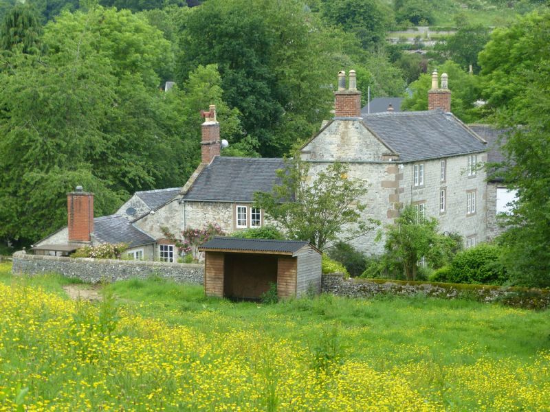
House. Late C18. Coursed squared limestone with sandstone dressings. Plain
tile roof and stone coped gables with plain kneelers. Brick gable end stacks.
Three storeys with flush quoins. L-plan with lower rear wing. East elevation -
Double-fronted. Central doorway with stone quoins and lintel. C19 half-glazed
door with rectangular overlight. Flanked on each side by 2-light square section
flush mullion windows. Above the doorway, a single-light window with flush stone
surround. Flanked slightly lower down on each side by 2-light square section
flush mullion windows. Top floor with a central single-light window with flush
stone surround, flanked on each side by 2-light square section flush mullion
windows. Massive stone steps on the north side.
Listing NGR: SK1865054331
External links are from the relevant listing authority and, where applicable, Wikidata. Wikidata IDs may be related buildings as well as this specific building. If you want to add or update a link, you will need to do so by editing the Wikidata entry.


Other nearby listed buildings
