Latitude: 52.9629 / 52°57'46"N
Longitude: -1.5359 / 1°32'9"W
OS Eastings: 431268
OS Northings: 340716
OS Grid: SK312407
Mapcode National: GBR 6DD.8HM
Mapcode Global: WHCFG.CSVF
Plus Code: 9C4WXF77+5J
Entry Name: The Bridge and Cascade
Listing Date: 13 February 1967
Last Amended: 13 March 1967
Grade: I
Source: Historic England
Source ID: 1335352
English Heritage Legacy ID: 78891
ID on this website: 101335352
Location: Amber Valley, Derbyshire, DE22
County: Derbyshire
District: Amber Valley
Civil Parish: Weston Underwood
Traditional County: Derbyshire
Lieutenancy Area (Ceremonial County): Derbyshire
Church of England Parish: Mugginton and Kedleston All Saints
Church of England Diocese: Derby
Tagged with: Bridge
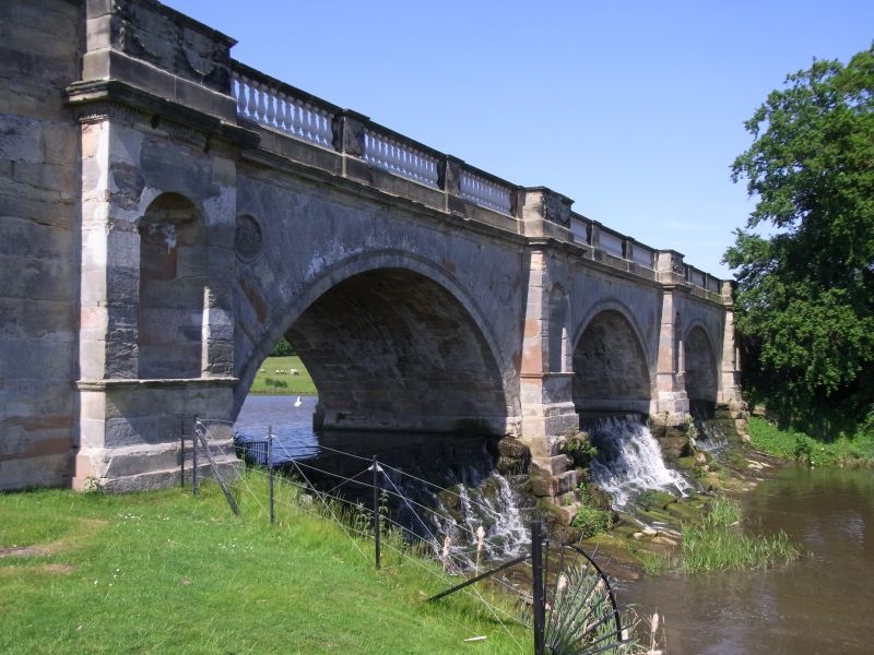
SK 34 SW PARISH OF KEDLESTON KEDLESTON PARK 3/52 The Bridge and 13.2.67 Cascade I Bridge and cascade. Designed with a single arch by Robert Adam in 1761. Redesigned, with three arches in 1764. Executed 1770- 1771. Ashlar. The bridge has three round-arched spans with moulded hoodmoulds. Fluted roundels in the spandrels. Projecting piers with apsed niches and moulded sill band. The tops of the piers with swags. Fluted frieze and dentil cornice. Balustraded parapet the balusters divided into three units per span. Cast iron balusters. Steep road approaches with the end walls curving outwards and downwards. End piers. Rubblestone cascade to east.
Listing NGR: SK3126840716
External links are from the relevant listing authority and, where applicable, Wikidata. Wikidata IDs may be related buildings as well as this specific building. If you want to add or update a link, you will need to do so by editing the Wikidata entry.


Other nearby listed buildings