Latitude: 54.291 / 54°17'27"N
Longitude: -2.8813 / 2°52'52"W
OS Eastings: 342728
OS Northings: 488736
OS Grid: SD427887
Mapcode National: GBR 8L9T.ZK
Mapcode Global: WH830.QD4S
Plus Code: 9C6V74R9+CF
Entry Name: Outbuildings to West and North of Cowmire Hall
Listing Date: 21 November 1952
Grade: II
Source: Historic England
Source ID: 1335803
English Heritage Legacy ID: 77090
ID on this website: 101335803
Location: Pool Bank, Westmorland and Furness, Cumbria, LA8
County: Westmorland and Furness
District: South Lakeland
Civil Parish: Crosthwaite and Lyth
Traditional County: Westmorland
Lieutenancy Area (Ceremonial County): Cumbria
Church of England Parish: Crosthwaite St Mary
Church of England Diocese: Carlisle
Tagged with: Appendage
CROSTHWAITE AND LYTH SD 48 NW 3/2 Outbuildings to west 21.11.52 and north of Cowmire Hall (q.v.)
G.V. II
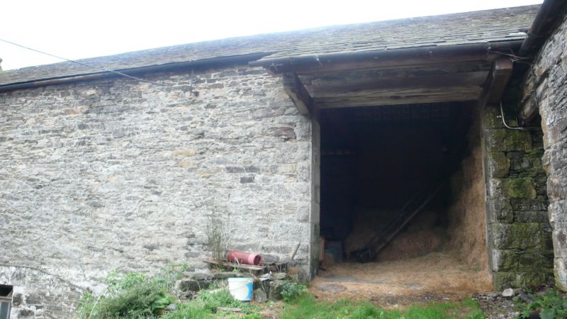
Farmbuildings around 3 sides of courtyard, with the Hall to east end of south range. South range and east half of north range probably early C18, the rest mid-late C19. Stone rubble with slate roofs. South range has to north elevation a wide through passage to east of ramp leading to barge entrance with pentice. 6-light chamfered wooden-mullion window rebated for glazing and with 4-intermediate bars over passage. South elevation has dripcourses, paired doors to passage, with ventilation slots over, inserted window. West gable end has entrance with pentice, window and ventilation slots. 2 tie beam and strut trusses and 2 C19 kingpost trusses; cow house has some chamfered beams and stop-chamfered joists. West range adjoins to north (with limestone trough in angle), C19 bank barn with limestone quoins. Gable-end ball finials. West elevation has pentice on limestone brackets over 6 cow house entrances, one now window. Some slate partitions. Winnowing door towards north end. East elevation has ramp to north end, with entrance with canopy on limestone brackets. Entrance, entrance now window and window to south; passage through ramp. Owl hole in gable end. North range western part has 2 large openings with central limestone piers to south elevation possibly a later insertion, entrance to granary from barn ramp; granary has slate skirting and corn bins. Eastern end has 2 entrances and 3 windows to stables, loading door to western part, 1st floor entrance up steps to eastern part, with 6-light chamfered wooden-mullion window with 2 remaining intermediate bars to left. Central straight joint indicates possible rebuilding of part of wall. North elevation has blocked entrance and small windows. East gable-end has small 1st floor window. Interior of eastern end has remains of chimney hood to 1st floor, later fireplace to gable end.
Listing NGR: SD4272888736
External links are from the relevant listing authority and, where applicable, Wikidata. Wikidata IDs may be related buildings as well as this specific building. If you want to add or update a link, you will need to do so by editing the Wikidata entry.


Other nearby listed buildings