Latitude: 51.336 / 51°20'9"N
Longitude: 1.4142 / 1°24'51"E
OS Eastings: 637910
OS Northings: 165196
OS Grid: TR379651
Mapcode National: GBR X0L.4CY
Mapcode Global: VHMCW.GPH4
Plus Code: 9F338CP7+CM
Entry Name: Water Tower and Adjacent Range to North West, About 50 Metres East of Cannon Brewery Buildings
Listing Date: 4 February 1988
Grade: II
Source: Historic England
Source ID: 1336618
English Heritage Legacy ID: 171704
ID on this website: 101336618
Location: Ramsgate, Thanet, Kent, CT11
County: Kent
District: Thanet
Civil Parish: Ramsgate
Built-Up Area: Ramsgate
Traditional County: Kent
Lieutenancy Area (Ceremonial County): Kent
Tagged with: Water tower
TR 3765 SE
8/75
RAMSGATE
CANNON ROAD
(north-west side)
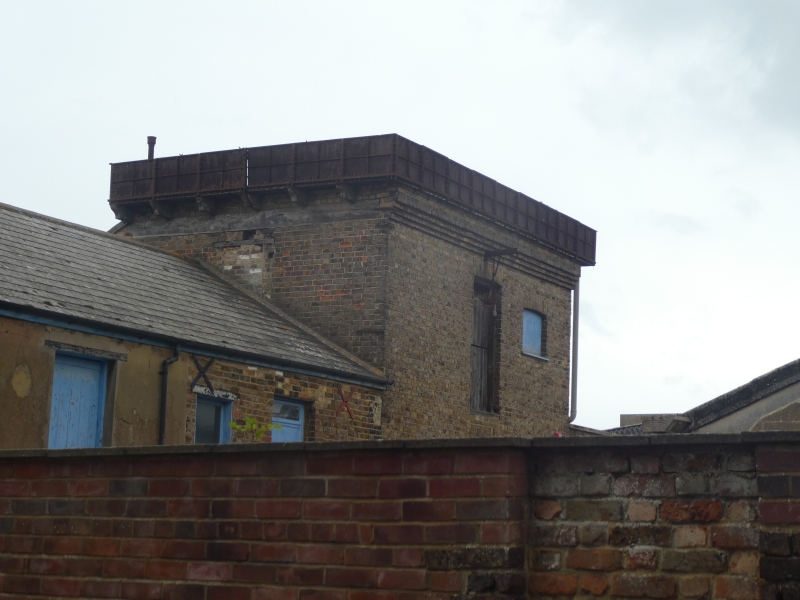
Water Tower and adjacent range to north west, about 50 metres east of Cannon Brewery buildings
GV
II
Water tower and brewery buildings. Mid C19. Stock brick and slate roof.
Water tower of 3 storeys, with cast iron tank projecting at top on iron
brackets and brick corbelling. Boarded doors on each floor, with hoist
and pulley over top door, and segmental openings to right on each floor
with iron grills. Range to north-west of 2 storeys, with irregular
fenestration and boarded door on 1st floor, and C20 vehicle doors on
ground floor. The shell of a similar range survives to south-east, but
is gutted and heavily rebuilt, in use as garage premises. Originally
part of the brewery complex of the Cannon Brewery, the main range and
oasts of which survive 50 metres to the west. Included for group value.
Listing NGR: TR3791065196
External links are from the relevant listing authority and, where applicable, Wikidata. Wikidata IDs may be related buildings as well as this specific building. If you want to add or update a link, you will need to do so by editing the Wikidata entry.


Other nearby listed buildings