Latitude: 51.2824 / 51°16'56"N
Longitude: 1.0826 / 1°4'57"E
OS Eastings: 615069
OS Northings: 158206
OS Grid: TR150582
Mapcode National: GBR TY2.JJ6
Mapcode Global: VHLGM.Q168
Plus Code: 9F3373JM+W2
Entry Name: St Radigund Hall
Listing Date: 3 December 1949
Grade: II*
Source: Historic England
Source ID: 1336812
English Heritage Legacy ID: 170574
ID on this website: 101336812
Location: Northgate, Canterbury, Kent, CT1
County: Kent
District: Canterbury
Electoral Ward/Division: Westgate
Parish: Non Civil Parish
Built-Up Area: Canterbury
Traditional County: Kent
Lieutenancy Area (Ceremonial County): Kent
Tagged with: Architectural structure
1. 944 CHURCH LANE ST RADIGUND'S
Nos 3 to 9 (odd ) (St Radigund Hall ) (Formerly listed under Church Lane, Northgate) TR 1558 SW 3/95 3.12.49.
II*
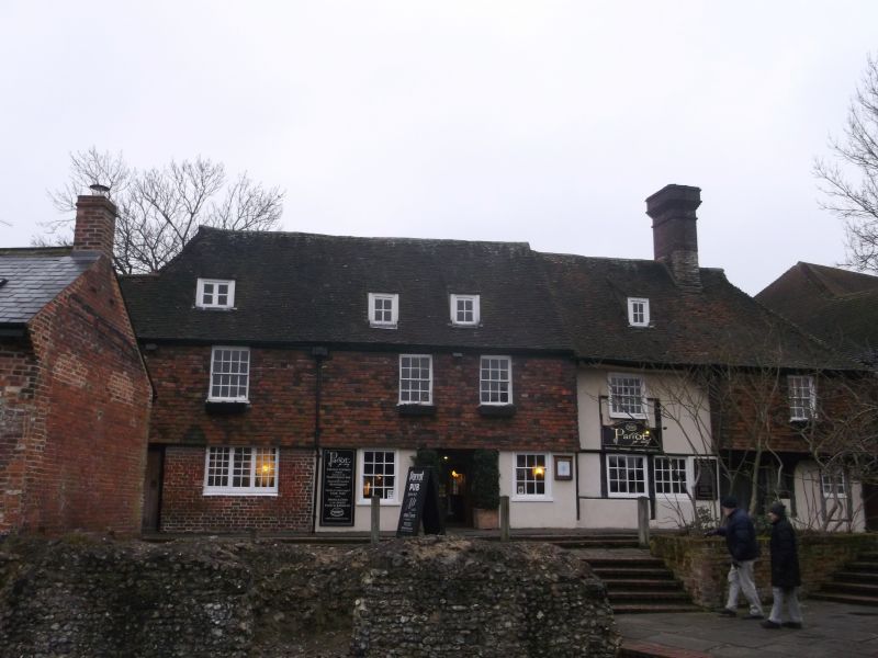
2. C15 timber-framed house of Wealden type with projecting wings and recessed centre. 2 storeys and attic. Ground floor now stuccoed, above tile-hung. Tiled roof with 3 dormers. The lst floor of the 2 wings is overhanging on brackets, and the curved braces on the 1st floor of the centre portion support the eaves. 4 windows. One original window with wooden mullions on the ground floor of the west wing. Another (blocked) in the centre of the recess on the lst floor, but a sash has been out through-file top of this. The other windows are sashes on modern windows. 2 original doors with peep-holes in them, one with spandrels carved with quatrefoils. The rear wing is of brick (part plastered), with curved braces visible, The windows are sashes and sliding sashes. A restored 4 centred door with plain spandrels. The interior has a fine roof with crown posts and brackets. Curved braces.
Listing NGR: TR1506958206
External links are from the relevant listing authority and, where applicable, Wikidata. Wikidata IDs may be related buildings as well as this specific building. If you want to add or update a link, you will need to do so by editing the Wikidata entry.


Other nearby listed buildings