Latitude: 51.3608 / 51°21'38"N
Longitude: 1.0263 / 1°1'34"E
OS Eastings: 610786
OS Northings: 166761
OS Grid: TR107667
Mapcode National: GBR TX1.N90
Mapcode Global: VHKJR.Q2Y4
Plus Code: 9F33926G+8G
Entry Name: The Methodist Chapel
Listing Date: 17 June 1975
Grade: II
Source: Historic England
Source ID: 1336853
English Heritage Legacy ID: 170777
ID on this website: 101336853
Location: Whitstable, Canterbury, Kent, CT5
County: Kent
District: Canterbury
Electoral Ward/Division: Gorrell
Parish: Non Civil Parish
Built-Up Area: Whitstable
Traditional County: Kent
Lieutenancy Area (Ceremonial County): Kent
Tagged with: Chapel
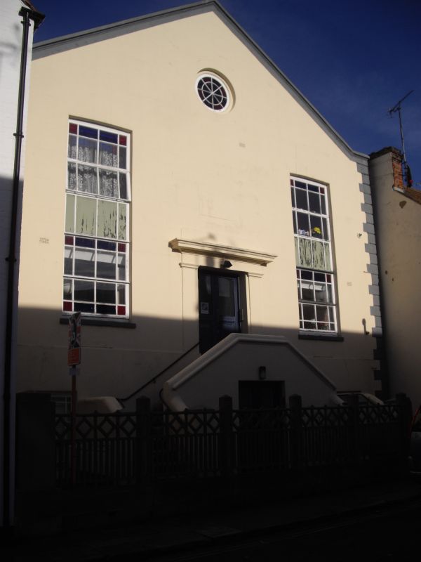
ALBERT STREET 1. 5273 (North Side) The methodist Chapel TR 1066 NE 1/61 17.6.75. II 2. Date stone of 1864 above the entrance. Rendered brick facade with quoins and marked to resemble stone. Gable with moulded coping. 2 flights of stairs up to central doorway having pilasters and entablature. Pair of doors with 1 panel each, bolection moulds and similar pair of doors under landing to front entrance. 2 windows to main building with bulls-eye over end windows under, all glazing bars complete. Modern concrete railings to forecourt. Red brick at rear, glazing bars complete in windows.
Listing NGR: TR1078666761
External links are from the relevant listing authority and, where applicable, Wikidata. Wikidata IDs may be related buildings as well as this specific building. If you want to add or update a link, you will need to do so by editing the Wikidata entry.


Other nearby listed buildings