Approximate Location Map
Large Map »
Latitude: 51.8687 / 51°52'7"N
Longitude: 0.6848 / 0°41'5"E
OS Eastings: 584940
OS Northings: 222313
OS Grid: TL849223
Mapcode National: GBR QKD.ZXJ
Mapcode Global: VHJJL.T9D8
Plus Code: 9F32VM9M+FW
Entry Name: Riverside Cottage
Listing Date: 6 September 1988
Grade: II
Source: Historic England
Source ID: 1337965
English Heritage Legacy ID: 116156
ID on this website: 101337965
Location: Coggeshall, Braintree, Essex, CO6
County: Essex
District: Braintree
Civil Parish: Coggeshall
Built-Up Area: Coggeshall
Traditional County: Essex
Lieutenancy Area (Ceremonial County): Essex
Church of England Parish: Coggeshall with Markshall
Church of England Diocese: Chelmsford
Tagged with: Cottage
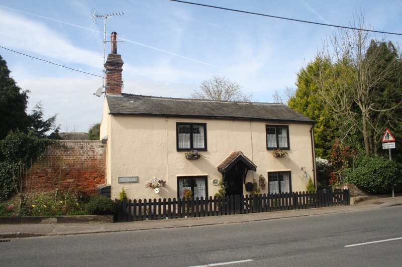
TL 8422-8522 COGGESHALL GRANGE HILL
(west side)
9/126 No. 2 (Riverside
Cottage)
GV II
Cottage. Early C17, altered in C19 and C20. Timber framed, plastered, roofed
with slate. Single range facing E with axial stack at left end, originally
external, now internal, and C19/20 stack to rear right. 2 storeys. C20 single-
storey lean-to extension with slate roof along full length of rear, and
projecting to right; C20 flat-roofed extension to left. 2-window range of C20
casements with rectangular leading. Plain boarded door with C20 gabled and
tiled canopy on brackets. Originally this was a single-storey cottage; the
walls have been raised approximately 1.40 metres and the roof rebuilt to a slate
pitch. Chamfered axial beam with runout stops in left bay, boxed in right bay.
One original roof truss is preserved in the intermediate partition. Large
wood-burning hearth with 0.33 metre jambs and a seat in each inglenook, of C16
and C17 bricks. In 1980 a child's shoe datable to c.1700, items of children's
clothing and clay pipes were found in this stack, now in Colchester Museum and
in the possession of the owner. Shown as one of a line of buildings in a map of
1639 (Essex Record Office, D/DOp P.1).
Listing NGR: TL8494022313
External links are from the relevant listing authority and, where applicable, Wikidata. Wikidata IDs may be related buildings as well as this specific building. If you want to add or update a link, you will need to do so by editing the Wikidata entry.


Other nearby listed buildings
