Latitude: 51.6438 / 51°38'37"N
Longitude: -2.2002 / 2°12'0"W
OS Eastings: 386240
OS Northings: 193908
OS Grid: ST862939
Mapcode National: GBR 1NR.VZB
Mapcode Global: VH95B.TY57
Plus Code: 9C3VJQVX+GW
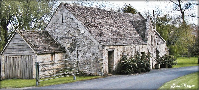
Entry Name: Barn Approximately 70 Metres South East of Beverston Castle at Castle Farm
Listing Date: 6 September 1954
Grade: II
Source: Historic England
Source ID: 1341160
English Heritage Legacy ID: 130346
ID on this website: 101341160
Location: Beverston, Cotswold, Gloucestershire, GL8
County: Gloucestershire
District: Cotswold
Civil Parish: Beverston
Traditional County: Gloucestershire
Lieutenancy Area (Ceremonial County): Gloucestershire
Church of England Parish: Beverston St Mary the Virgin
Church of England Diocese: Gloucester
BEVERSTON BEVERSTON VILLAGE ST 8693 13/31 Barn approximately 70m south east of Beverston Castle, known as Pilgrims Barn, at Castle Farm 6.9.54 II
Small barn. Said to be C14. Random coursed and snecked rubble stone, stone slate roof with coped south gable and saddlestone. Small plain buttresses to just below eaves level on front, diagonal buttresses to south end and 2 raking buttresses to rear with 2 stepped buttresses between. Gable to right on west side, also coped with saddlestone, and with chamfered stone loft opening. Chamfered stone doorway immediately to left, with recessed stable door, doorway with timber lintel to far left with recessed C20 door, slit vents between and throughout with large stone quoins and inner splays. Interior of 5 bays including one base cruck truss to right of centre, with small upper crucks to this truss and those to each side. North truss and much of roof structure renewed. Purlins probably mostly original, with few remaining pieces of arched wind bracing formerly to lower tier on both sides. Ancient Monument, Gloucestershire AM 353.
Listing NGR: ST8624193911


Other nearby listed buildings