Latitude: 51.6447 / 51°38'40"N
Longitude: -2.2012 / 2°12'4"W
OS Eastings: 386172
OS Northings: 194003
OS Grid: ST861940
Mapcode National: GBR 1NR.VP0
Mapcode Global: VH95B.SXNL
Plus Code: 9C3VJQVX+VG
Entry Name: Drew and Two Unidentified Monuments, About 6-12 Metres South of South East End of Aisle in Churchyard of Church of St Mary
Listing Date: 16 March 1987
Grade: II
Source: Historic England
Source ID: 1089722
English Heritage Legacy ID: 130350
ID on this website: 101089722
Location: St Mary's Church, Beverston, Cotswold, Gloucestershire, GL8
County: Gloucestershire
District: Cotswold
Civil Parish: Beverston
Traditional County: Gloucestershire
Lieutenancy Area (Ceremonial County): Gloucestershire
Church of England Parish: Beverston St Mary the Virgin
Church of England Diocese: Gloucester
Tagged with: Monument
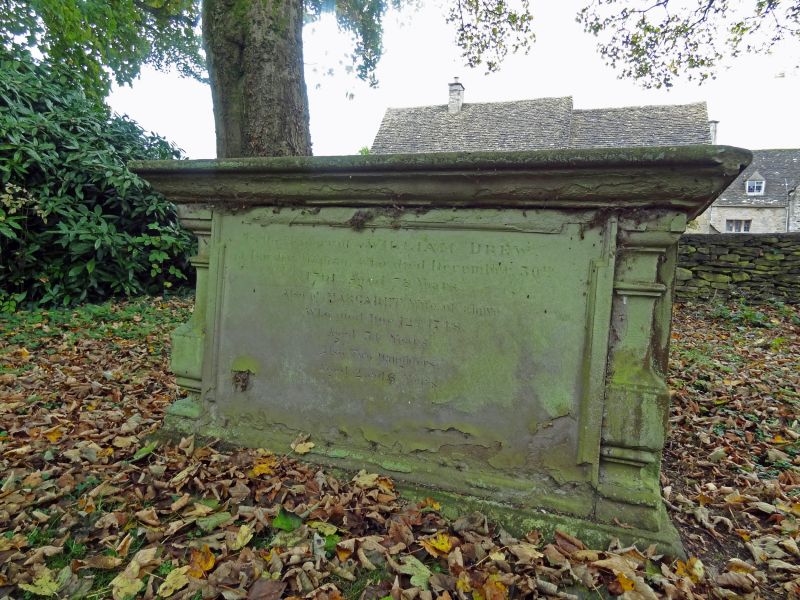
BEVERSTON BEVERSTON VILLAGE ST 8693 Drew and two Unidentified 13/35 Monuments, about 6-12m south of south-east end of aisle in church- yard of Church of St. Mary II GV Three chest tombs. From north to south: 1) Unidentified, probably late C17. Limestone. Flat top, moulded plinth and capping, plain slab ends and sides with incised inscription on south side. Large piece missing from top on north side. 2) Unidentified, mid C18. Limestone. Flat top, moulded plinth and capping, slightly indented ends with carved returns, plain fielded rectangular side and end panels. 3) William Drew 1791. Sandstone. Flat top, moulded plinth and capping. Quarter baluster corners, fielded end panels with arched tops, recessed rectangular side panels.
Listing NGR: ST8617294003
External links are from the relevant listing authority and, where applicable, Wikidata. Wikidata IDs may be related buildings as well as this specific building. If you want to add or update a link, you will need to do so by editing the Wikidata entry.


Other nearby listed buildings